Ptarmigan Peak (13,739′) & Weston Peak (13,572′)
San Isabel & Pike National Forests | Twin Lakes, CO
06/19/21 | 4.65 miles | 2,144′ gain | YDS Class 2

I had a bad feeling when I still hadn’t heard from Allie an hour into my drive. We were meeting up to climb a peak near Buena Vista, about the halfway point between our towns. She should have left about the same time I did, and she should have texted by now to let me know she’d left home. I finally heard from her an hour later; she had some issues with her alarm and had just woken up. We unfortunately had storms forecasted for the afternoon, so a late start would not be a great idea. (Plus I didn’t really feel like waiting at the trailhead for two hours.)
After a quick brainstorm, we decided to split up and hike separately. The hike I chose was a bit closer to home, so no harm done. It was very early and I was the first up Weston Pass. I’d never driven up this pass before but it is a decent gravel road, plenty easy in a crossover but probably challenging in a sedan.

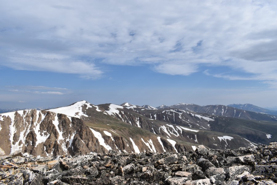
The hardest part of the route is visible in the above picture. Behind the Weston Pass sign, the route follows an old road to the base of a steep slope. The slope leads up to a ridge 1400′ above Weston Pass, and from there both Ptarmigan and Weston Peaks are simple walks along the ridge. A very straightforward route, perfect as a backup with little research required.


It was a nice warm-up walking the old road before the steep slope. Steep terrain slows me way down, but it’s a little easier if I have a more gradual start. The route roughly follows the county line, which also happens to be the boundary between the Pike and San Isabel National Forests.


A trail led partway up the slope but soon fizzled out. At least the route-finding was easy; just go up. This section took me forever. I had to stop often to catch my breath.


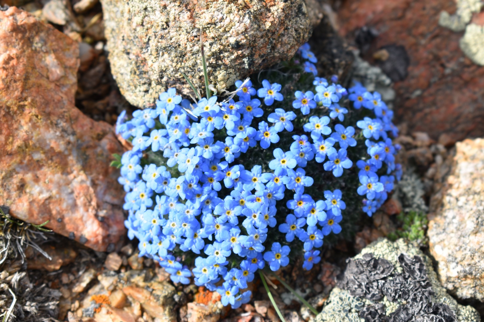
The slope kicked my butt, but at least there were always pretty views or vibrant wildflowers to keep me busy while I caught my breath. I eventually made it up to the ridge and could see my destinations…or so I thought.


I’d been watching the clouds all morning. They were pretty low and looked like they could turn angry quickly, so I was ready to bail if I needed to. The clouds looked worse over Weston Peak, so I started there first, hoping that I’d finish before they let loose.

Weston Peak was a simple ridge walk, but I did have to go up and down a small, rocky bump along the way. There were trail segments all along the ridge, but nothing that lasted long. Neither Weston nor Ptarmigan Peaks are ranked, which means they don’t rise more than 300′ from the next peak. For me, this only meant that even with all the ups and downs along the ridge, none were very tall. Weston looked pretty tall from the low point, but in reality was just a 250′ climb. Easy-peasy.

The summit was unremarkable, but the gray clouds were dissipating and the sun was shining through. Oh, and I could finally see Ptarmigan Peak!


Since the weather was improving, I was becoming less worried about storms coming in anytime soon. I retraced my steps back along the ridge to where I had climbed up, checked the skies once more, and then continued on to Ptarmigan Peak.


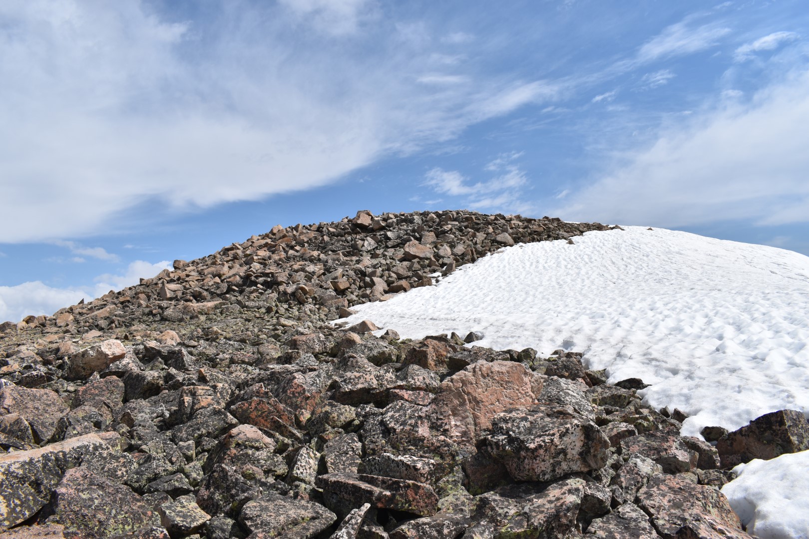
I skirted the unnamed bump, often on trail fragments. Ptarmigan’s summit soon came into view. This was an easy, nearly flat tundra walk. The summit itself was steeper talus but so short-lived that it felt easy.


My descent was straightforward. I followed my steps back along the ridge and used my tracker to figure out where I had climbed up, following nearly the same route down the steep slope. The looser sections became more apparent on the descent, but a slow, cautious pace kept me from slipping.


This was such a fun hike; short but steep, so it still felt like a good workout. A perfect one for me to do alone with little planning, and it even turned out to be a beautiful day.
I would like to acknowledge that Ptarmigan & Weston Peaks are on the ancestral land of the Núu-agha-tʉvʉ-pʉ̱ (Ute).
Chelsea

don’t know if I could have done this hike, much less alone. Love all the beautiful wild flowers. I was wondering – since you live in Colorado have you run in to rattlesnakes on any of your hikes? How often? Also I’d like if you’d share with us what equipment you use – hiking shoes/boots, trekking poles, etc. Thanks.
LikeLike
I very rarely run into snakes of any kind, and I have never seen a rattlesnake while hiking. They’re not uncommon, but they do a good job avoiding people. Rattlers in Colorado live below 9500′, so our higher elevations shouldn’t have any rattlers (or likely any snakes at all.)
As far as the equipment goes, what I use varies by season, hike length/difficulty, and trail/route conditions. I wear trail runners (Altra Timps) in the summer and very rarely use trekking poles. (Many people swear by poles, but I’ve never quite figured out the technique and so they just get in my way.) My day pack is a 22L Osprey (an amazing CO brand!) and I bring most of the Ten Essentials.
If you ever have any more questions, feel free to reach out via the Contact page on my site! 🙂 (Or you are more than welcome to comment on any post instead!)
LikeLiked by 1 person
Sorry to hear that your hike didn’t go as planned, but it’s always good to come prepared with a back-up. And hey, at least you managed to get out before the storm. I love all the various wildflowers on the trail.
LikeLike
I scrambled a little to find a backup for this one…thankfully I peruse maps and trip reports regularly (and had a bit of phone service) so I could make a quick plan 🙂
LikeLiked by 1 person
I love this one. The flower photos are so so gorgeous and the views look amazing! I’ve never even heard of Weston Pass… clearly it’s time for me to do some research into that area of the state.
LikeLike
It’s a small pass! One of a handful of driving tours around Fairplay. I think the booklets can be picked up at the ranger station in town. I haven’t done them yet, but I’ve seen the numbered posts and they look fun!
LikeLiked by 1 person
Nice hike. Looking at the topo map, trail looked steeper than in your photos.
LikeLike
I think the topo map is a little deceiving. Nothing on my track gets over 30°. But it certainly felt steep when I was on it!
LikeLike
This looks like such a pretty hike! It also doesn’t seem like too much elevation gain either, which is fantastic. I will say though, starting for summits at 11.900 feet is hard….you’re already tired! Those views are also way too pretty!!
LikeLike
It was a pretty short & simple hike, perfect for altitude training! I love starting high since it’s easier on my legs, but the lungs take much longer to catch up!
LikeLiked by 1 person
The terrain during your walk reminds me very much of our Lake District fells – probably higher, though. Good that you managed to get out for a wander even if solo. You have to make the most of the decent weather during the winter!
LikeLike
I’m always surprised to see how much areas around the world (of all different elevations) look so similar to places we have here! And this was from last June, I don’t think I could get even close to this area this time of year 🙂
LikeLiked by 1 person
Looks like a great plan B, good thing you’re organized! Love the alpine flowers. Maggie
LikeLike
Thanks Maggie! 🙂
LikeLike
I’ve always enjoyed the name (term?) Ptarmigan. That P, so present but silent, just does something for me. Great pics. Did you slide down the icefields on the way back? I always find that to be a fun reward for a solid climb. 🙂
LikeLike
I didn’t! These were all sloping in the wrong direction, but I will typically slide down if the conditions are right 🙂
LikeLiked by 1 person
Really engaging writing! We love hiking Colorado and appreciate you sharing your journeys ✌️
LikeLike
Thank you so much!
LikeLike
Beautiful photos and good place for hiking thanks for sharing 😊👍👍😌
LikeLike
Thank you 🙂
LikeLike
You are welcome 😊👌stay blessed ❤💕
LikeLike
You may already know this, but there is also a Ptarmigan Peak (12,495′) in Summit County near Silverthorne. Fairly straightforward hike with nice views of the Gore Range (Buffalo Mtn, Red Peak, Mt Silverthorne).
LikeLike
I hadn’t heard of that Ptarmigan, but I’ve had Buffalo & Red on my list for a very long time. Still haven’t climbed anything in the Gore. Maybe this year!
LikeLike
Way to go on not abandoning your day, and finding not one, but two great summits. I actually like hiking alone sometimes, and find I can really connect with the intense mountain energy when I’m by myself.
LikeLike