
Royal Arch | Boulder Open Space & Mountain Parks
Boulder, CO | 09/17/20 | 4.54 miles | 1,405′ gain

Tori’s friend was visiting from Ohio and wanted to go for a hike in Boulder. We linked up on a Thursday to take him to the Royal Arch, one of the most iconic hikes in Chautauqua Park. Both Tori and I had already done this one via the standard 3.4 mile out-and-back route, but this time we decided to create a slightly longer 4.5 mile loop to visit some new trails.

Our loop started from the main Chautauqua trailhead. It wasn’t very busy at 8am on a Thursday and we easily found parking. We set out on the Chautauqua Trail in a beautiful meadow beneath the Boulder Flatirons. We turned left on the Bluebell Spur and soon entered the forest, staying there much of the rest of the hike. The trail junctions are marked, but some of the signs can be very confusing. It’s best to have a map when you hike here.

We very briefly turned onto Bluebell Road, passing the picnic shelter and quickly turning onto the out-and-back Royal Arch Trail.


The Royal Arch Trail is often steep as it climbs up to an overlook and then goes down and up again to the arch. Some sections can be difficult as you must navigate over or around boulders.

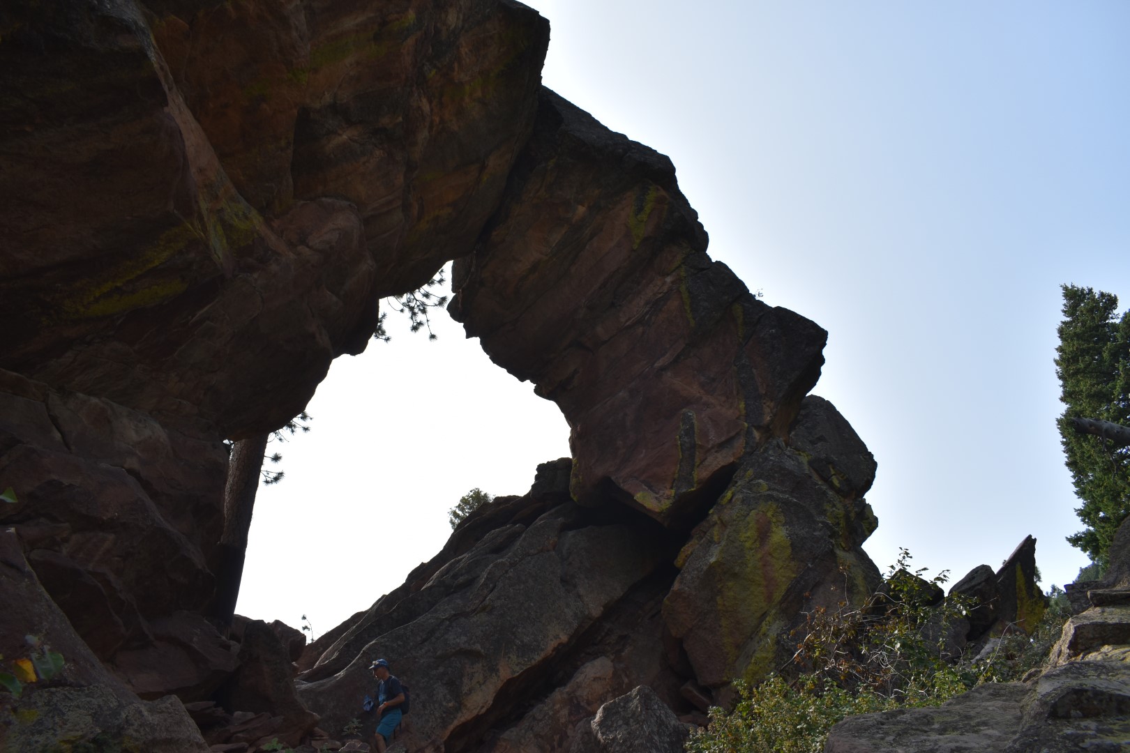
The Royal Arch Trail is about 0.8 miles one-way but it took us longer than expected. Finally we reached the arch, which was difficult to photograph due to lighting and angle.

The trail ends in the arch, but there are plenty of nice places on the other side for a break.


We backtracked along the Royal Arch Trail (down and up and down again) and continued left on the Flatirons Loop.


We turned left on the Bluebell-Baird Trail and then took a right on the pretty Meadow Trail, which took us back to the trailhead.


A repeat, but a fun one that can be done again and again, always taking a slightly different route.
Chelsea

Beautiful scenery and easily accessible. It has been years and my memory is fuzzy, but I think I hiked at least a little in this area, when my oldest son was a student at CU.
LikeLike
CU is super close by, so I’d say it’s likely you did visit Chatauqua!
LikeLike
Great to see familiar pictures. We were there a few years ago and want to return. Nice post!
LikeLike
Boulder has some great hiking, thanks for reading!
LikeLike
one of our fave hikes to take visitors on.
LikeLiked by 1 person
Oh the Flatirons! How I miss this place
LikeLiked by 1 person
We did this hike in March one time and as the trail climbed it was very icy. I had spikes so I was ok, but my ex was like skiing down on his tennis shoes, fell three times, and no one saw him. Once we got to the meadow I was relieved I didn’t wipe out and then I slid in the mud and wiped out in front of everyone!
LikeLike
Oh no, I hate that! I always happen to fall when there’s a large group of people right next to me. I can imagine this trail can get pretty nasty when there’s ice.
LikeLike
Looks like a great hike!
LikeLiked by 1 person
Cant wait for travel restrictions to end. Colorado is on my bucket list. Awesome photos, really inspiring.
LikeLike
I couldn’t agree more! A long trip would be very nice right now. Thanks for reading 🙂
LikeLike