
“Igloo Peak” (13,060′) | CO Rank: Unranked
“Mountain Boy Peak” (13,198′) | CO Rank: 491/637
Sawatch Range | Collegiate Peaks Wilderness | Twin Lakes, CO
09/05/20 | 7.48 miles | 2,454′ gain | Class 2

My Labor Day weekend plans fell through last minute and I unexpectedly found myself scrambling to come up with something I could do by myself. After some quick research, I realized the Independence Pass area had everything I was looking for: plenty of 13ers to climb, plenty of people around for safety, and plenty of secluded spots to sleep in my car overnight. It was an easy choice and I set out early Saturday morning, intending to climb Igloo Peak and Mountain Boy Peak that day. I was both nervous and excited for my first solo overnight trip. I brought my dog Lady for company.
After a 3.5 hour drive, I made it to Independence Pass. Even though the area is insanely touristy, 9am was plenty early enough to get front row parking.

An unmarked trail leaves the paved walkway and heads south along the Continental Divide. Once off the pavement, the number of people reduced drastically.

The trail stays nice and gradual all the way to the top of Igloo Peak. It might not be ranked (or officially named) but Igloo is a gentle 13er that would be great for a beginner.


There is quite a bit of up and down on the way to Igloo, but it didn’t feel strenuous like this often can.


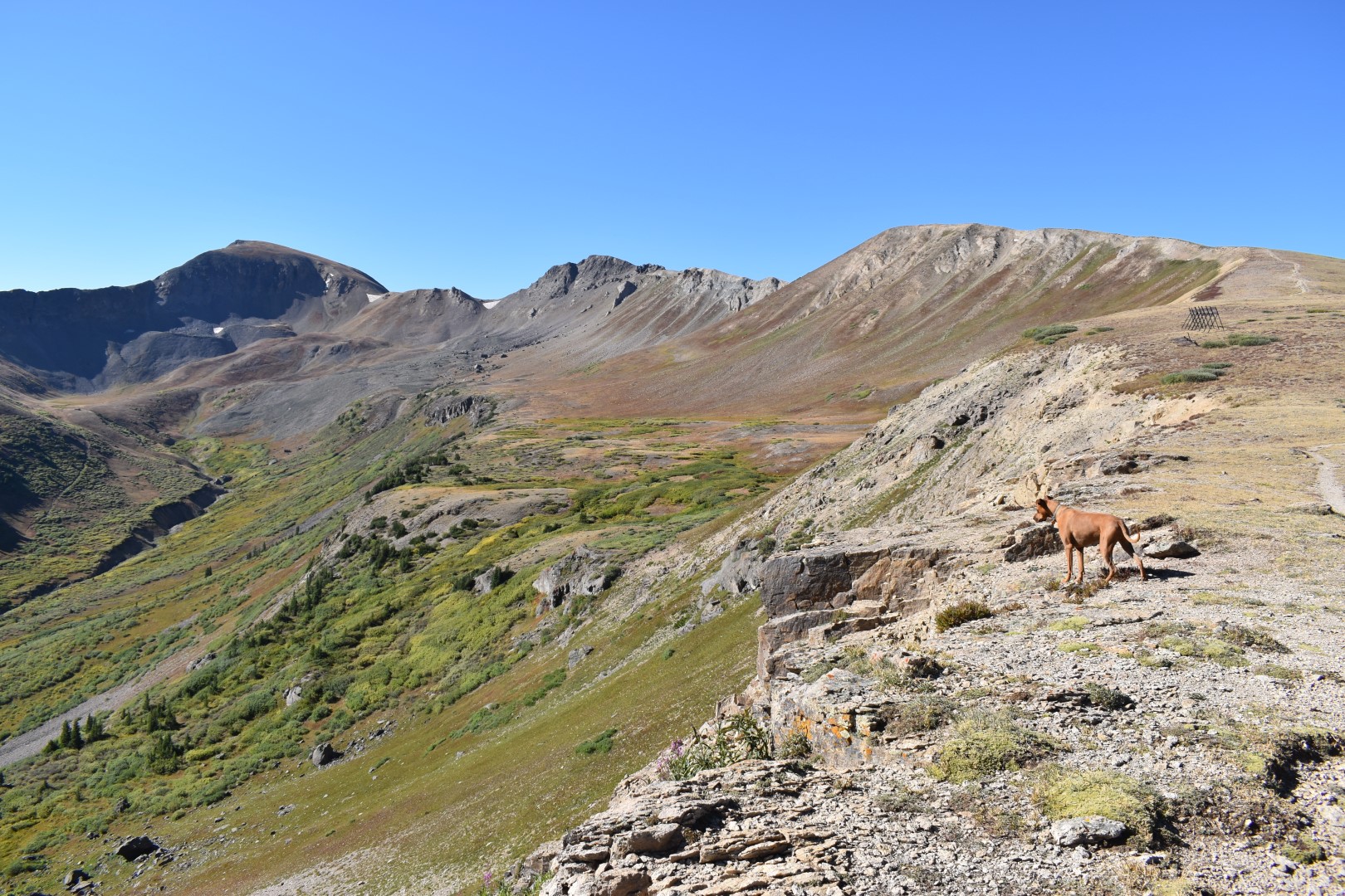
The views were incredible from Igloo, particularly of Grizzly Peak. Igloo is a worthwhile destination in and of itself, but I was feeling good and ready to visit a second summit.


The easy part of my hike was over and I needed to figure out how to get to Mountain Boy. The obvious answer would be to follow the ridge directly, but all of the reports say do NOT do that as Igloo’s east ridge is dangerously loose Class 4. I obviously wanted no part of that, so I backtracked slightly to the small saddle between Igloo and the first false summit. I recalled seeing a faint trail heading downwards that looked worth a try.

I needed to wrap around the south side of Igloo, bypassing any cliffs and dangerous areas. The trail didn’t last long but I kept heading down the loose talus. As long as I went slow I felt safe, though still a bit nervous. I checked my map often to make sure I was staying on track.

From here, others side-hilled across the south slope, losing as little elevation as possible on the way to the Igloo/Mountain Boy saddle. I do believe this would be a safe option for many, but I wasn’t comfortable so I attempted to find another way.

About 250 feet below me was a bench. I feel more comfortable going straight up or straight down steep/loose talus (instead of across) so I half walked/half slid down to the bench. I would have to regain this 250′ later, but the extra effort was worth me feeling more comfortable.

I followed the bench around the south side of Igloo until I could see the Igloo/Mountain Boy saddle. There was an easy route all the way up, mostly on grass and dirt.


From the saddle, I hiked up Mountain Boy’s western slope. The lower section is pretty loose and a number of trails (possibly game trails) criss-cross the area. I found heading straight up to be easier than following the more obvious trail on the right.

It was less than 400′ to the summit from the saddle, but I was beginning to tire. Just when I thought I wasn’t going to make it, I looked at my map and saw I was only 100′ away. Okay, there’s no way I’m turning back now!
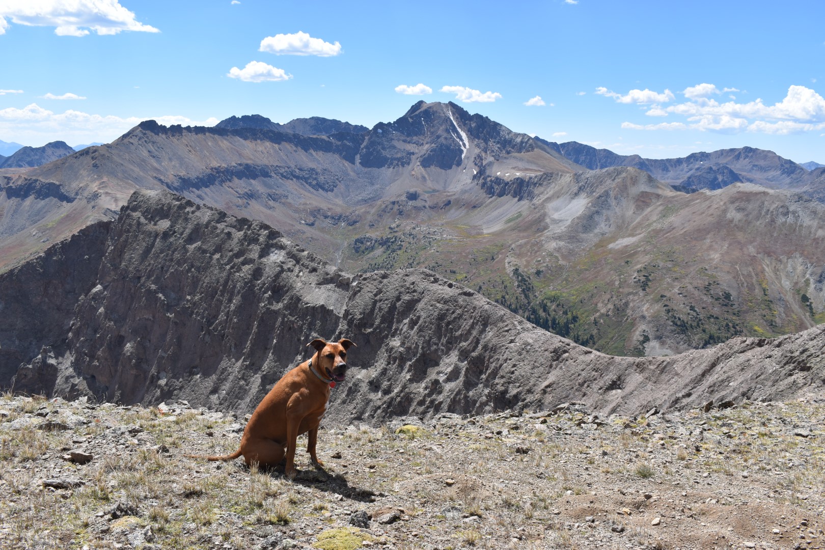

I finally made it to the big, flat summit. I was completely alone. In fact, I hadn’t seen a single person since I left Igloo. After a short break, it was time to get moving. I was doing a loop so I still had new terrain to figure out.
My next step was to head back down to the Igloo/Mountain Boy saddle. A gully drops down into Mountain Boy Park from the western side of the saddle. It was late enough in the year that the snow was nearly gone and I was able to stay on loose dirt and rock. If I haven’t made it obvious already, I really hate steep/loose terrain. I didn’t particularly like the gully but it wasn’t any worse than what I’d been on already.


Once down the gully I crossed the nearly flat Mountain Boy Park, heading north to reconnect with the trail.

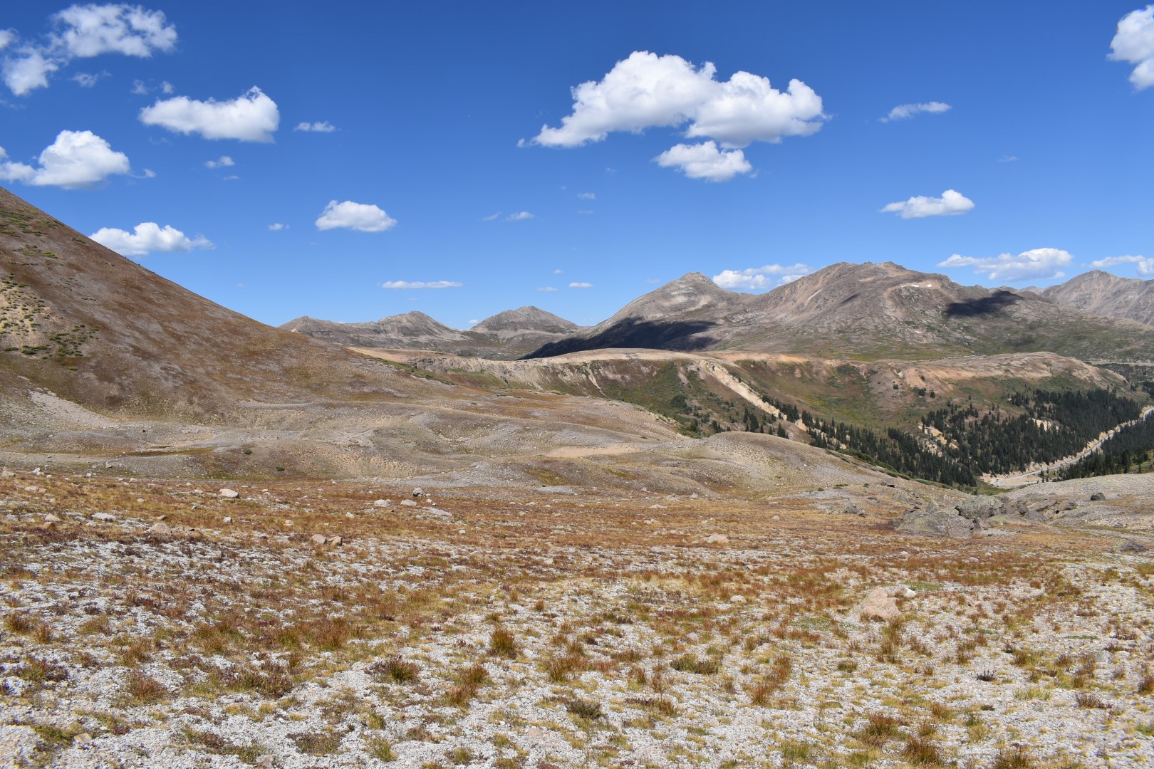
There was a short (but again loose and steep) climb back up to the trail on the opposite side of Mountain Boy Park. I aimed for a spot that looked relatively low angle and would avoid any snow and cliffs.

I hadn’t seen a single person in hours and it was at this point that I started to feel extremely accomplished, grateful, and just plain happy. I’d summited two new 13ers solo and on terrain that made me nervous, but I safely made it through.
The angle of the sun changed and began to illuminate the fall vegetation, creating a vibrancy that hadn’t been there before. I can’t believe my camera was able to pick this up. (See my below pictures vs. the above. None are edited, this is truly just what it looked like.)


Once I climbed up the last 100′ or so, I met back up with the trail and followed it all the way back to my car, now buried in a sea of people. I had to literally (and I actually mean literally) push my way through a crowd to get to my car. I booked it out of there and back down to Twin Lakes where I could call Kyle and check in.
I car camped near the Interlaken Trailhead at Twin Lakes Reservoir. There is a ton of dispersed camping and overnight parking for backpackers on the Colorado Trail. I found a safe and quiet overflow lot, away from the parties on the beach. Unfortunately we weren’t far enough away and guard dog Lady kept me up all night woofing at car doors, dogs barking, people shouting, etc. To say I didn’t get much sleep would be an understatement, and I (very crankily I might add) decided to just head home. I didn’t feel it would be responsible to climb any more 13ers as tired as I was, and the thought of another sleepless night in the car was more than I wanted to deal with.
Even though it ended early, I still felt happy with my first solo overnight trip. But maybe next time I’ll leave the guard dog at home so I can actually get some sleep.
Chelsea

Great hiking report Chelsea! I live just down valley in Glenwood Springs, so this will be on my list as soon as the snows in the upper reaches melt. Looks like a good warm-up for the Capitol Loop I plan to do in late June.
LikeLike
Thank you! You are lucky to live so close…I’m sure you will love this hike! I’ve never heard of the Capitol Loop, does it have anything to do with Capitol Peak?
LikeLike
Congratulations! You have so much technical knowledge, you should hire yourself out as a hiking guide. Difficult hike but didn’t seem to wear out your hiking buddy! 🙂
LikeLike
Oh wow, that’s very kind of you! I don’t think I’m quite there yet, but that would be a dream job for sure. Lady doesn’t seem to ever get tired…she just turned 8 years old and you wouldn’t even know it!
LikeLike
I used to look at the mountain heights in your posts and wonder how there were so many peaks at 13,000. Then I realized your state is at a very high altitude, Denver being called the Mile High City. Our city is at about 2,200 feet, so when we climb to 8,000 feet, we are still at significantly higher altitude than where we live. I can not imagine trying to hike at 13,000 without acclimatizing first. Thanks for sharing. Allan
LikeLike
We do have a large number of peaks about 13k! I live just below 5,000′ on the plains (near Greeley, CO). I don’t have too many issues with acclimating but I do usually get a headache after each high altitude hike. I think it helps that I get up there usually 1-2 times per week (at least in the summer).
LikeLike
Again a nice post from you Chelsea.
I have a question regarding the boulders off Igloo’s cliffs. Do you know if anyone has been boulder climbing there? If yes, are you aware of any topo from those boulders?
Thanks
LikeLike
Thank you! And a very good question. I don’t climb or boulder so I’m not in the proper communities to know for sure. I’m sure people HAVE, but I haven’t seen any reports or anything like that.
LikeLike
Ah, I see.
Thanks for the reply. I will search around on the internet in case I find some more information.
LikeLiked by 1 person
Putting this hike in my list, it’s beautiful there
LikeLike
You will love it! So much bang for your buck.
LikeLiked by 1 person
Well done!
LikeLike
Thank you! 🙂
LikeLike
I love that the hike allows you to go from peak to peak and all above tree line. We only have a few that are interconnected like that. Looks like a great day.
LikeLike
I love that too! It also helps that the parking lot is above treeline, makes for a bit of an easier day.
LikeLiked by 1 person
Doesn’t look like a difficult hike. I like hiking ridge lines.
LikeLike
It wasn’t too bad! Igloo has a trail the entire way so it’s very straightforward.
LikeLike
This looks like such an incredible hike. I’m with you, there’s something about walking across loose talus that feels unsettling. I’d much rather prefer to go up or down rather than across it. Also, I can’t help but enjoy some of the names of these mountains.
LikeLike
This area is so beautiful! I’m definitely getting better on loose terrain as I spend more time on it, but I don’t think I’ll ever like it lol. The names are always weird, I’m just rolling with it at this point lol!!
LikeLiked by 1 person
Fantastic journey – some of your photos look like they could be printed on canvas and hung on a wall!
LikeLike
Aw thank you so much!
LikeLiked by 1 person
Thanks for this informative post, really well done.
The next time we are travelling in the US we’ll do this hike as it doesn’t look that hard.
Thanks for sharing
The Fab Four of Cley
🙂 🙂 🙂 🙂
LikeLike
Thanks for reading 🙂 glad you found something new to do.
LikeLiked by 1 person
This sounds like a great adventure! Good for you, solo and two summits! Also, the guard dog is cute.
LikeLike
Thanks Laci! This ended up being one of my favorites of 2020.
LikeLiked by 1 person
I’m a little behind on my blog reading so apologies in advance for all the notifications you’re about to receive. Also, Igloo peak looks really neat!
LikeLike
Igloo was super cool! Would be a good one for you guys if you ever go through there. It’d only take a couple hours!
LikeLiked by 1 person
Great post Chelsea, and a good companion with you on the trip even if she did keep you awake!. My Border Collie ‘Mist’ is thirteen now, but she’s still up for a full mountain day.
LikeLike
Thanks Paul! Border Collies are amazing, still climbing at 13, wow! My ACDs are in the 10-12 range and really slowing down, can’t imagine them doing much at 13.
LikeLike