
Black Elk Peak (7,242′) | Custer State Park & Black Elk Wilderness
Custer, SD | 05/22/21 | 7.86 miles | 1,651′ gain
After a cold and foggy hike to North Dakota’s high point, Diana and I hoped for clear weather the next day when we would hike to South Dakota’s high point. Even with all of our fingers and toes crossed, we still woke up to fog once again. It appeared we simply wouldn’t get any views on this trip.
At 7,242′ in elevation, Black Elk Peak is not only the highest point in South Dakota, it’s the highest point east of the Rocky Mountains. The summit is situated in the Black Elk Wilderness but the main access point, Sylvan Lake, is in Custer State Park. Typically there is a $20/week fee to access Custer State Park, but somehow our trip coincided with South Dakota State Parks’ “free weekend”, so we were able to avoid the fee entirely.
Our hotel in Hill City was a short drive from the trailhead and we were on trail just after 7am. We had a lot more planned for the day than just summiting Black Elk Peak so we wanted to get an early start.
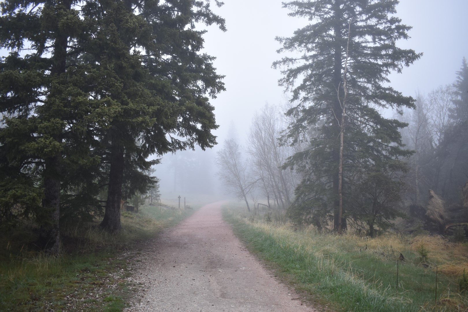
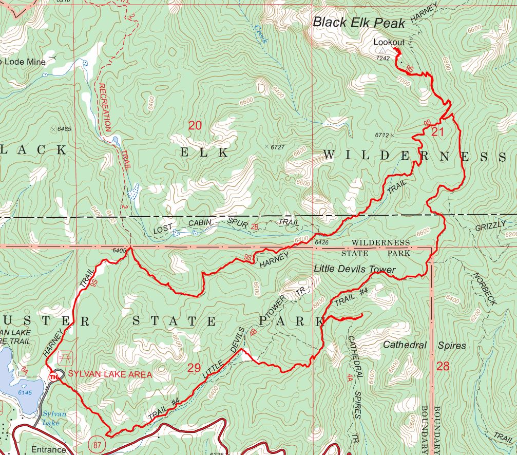
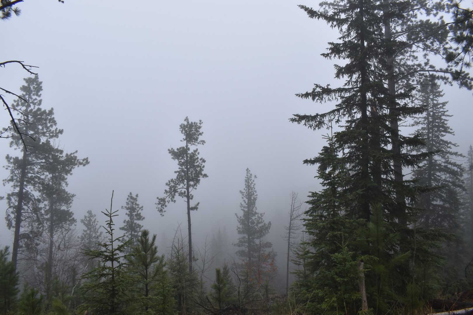
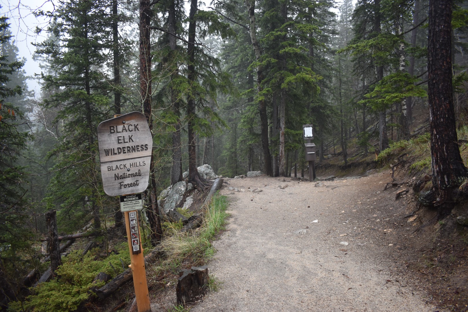
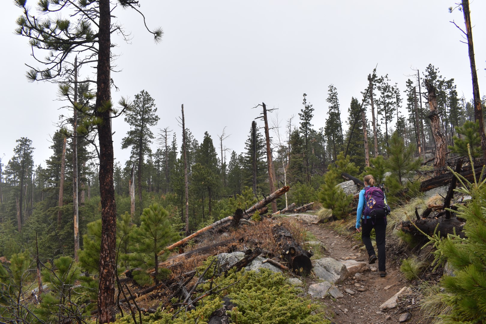
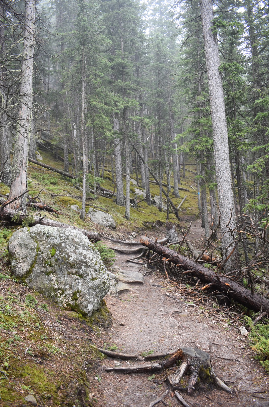
There are two main trails that depart from the Sylvan Lake Trailhead, the #9 (aka Harney Peak Trail) and the #4. In an effort to see as much as possible, we chose to combine both trails into a loop, taking the #9 Trail up and the #4 Trail down. The Black Hills are known for their soaring rock pinnacles and beautiful views but we couldn’t see a darn thing due to the fog.
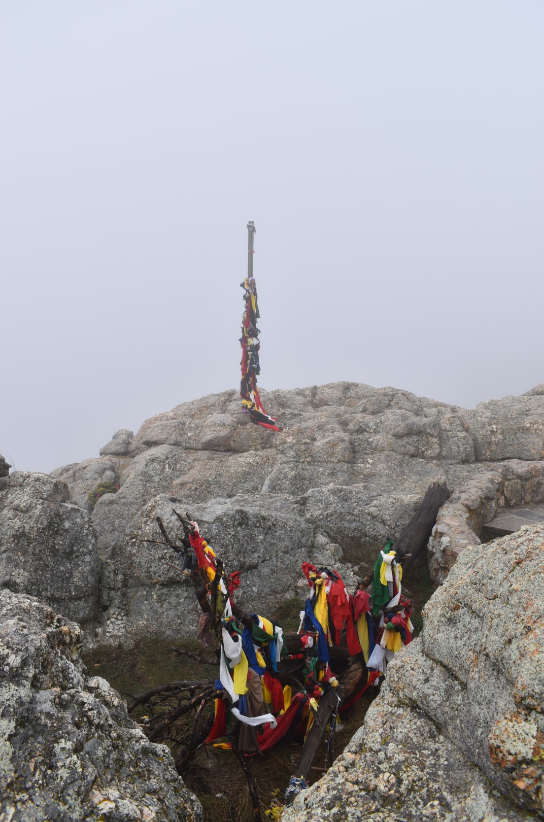
The mountain has had many names throughout its history, one of which proved to be controversial. Officially, it has only been called Black Elk Peak since 2016, when the Lakota tribe was finally granted the name change after a fifty-year effort. The peak was previously called Harney Peak in honor of US General William S. Harney. The same year the peak was named for him (1855), Harney led 600 troops in an attack against a Brulé Lakota camp of about 250 men, women, and children. They killed 86 Brulé, about half of which were women and children, and took 70 others as prisoners. The event is known as the Battle of Ash Hollow or the Harney Massacre. Both Black Elk Peak and the Black Elk Wilderness are named for Black Elk, a Lakota medicine man. The peak is considered sacred.
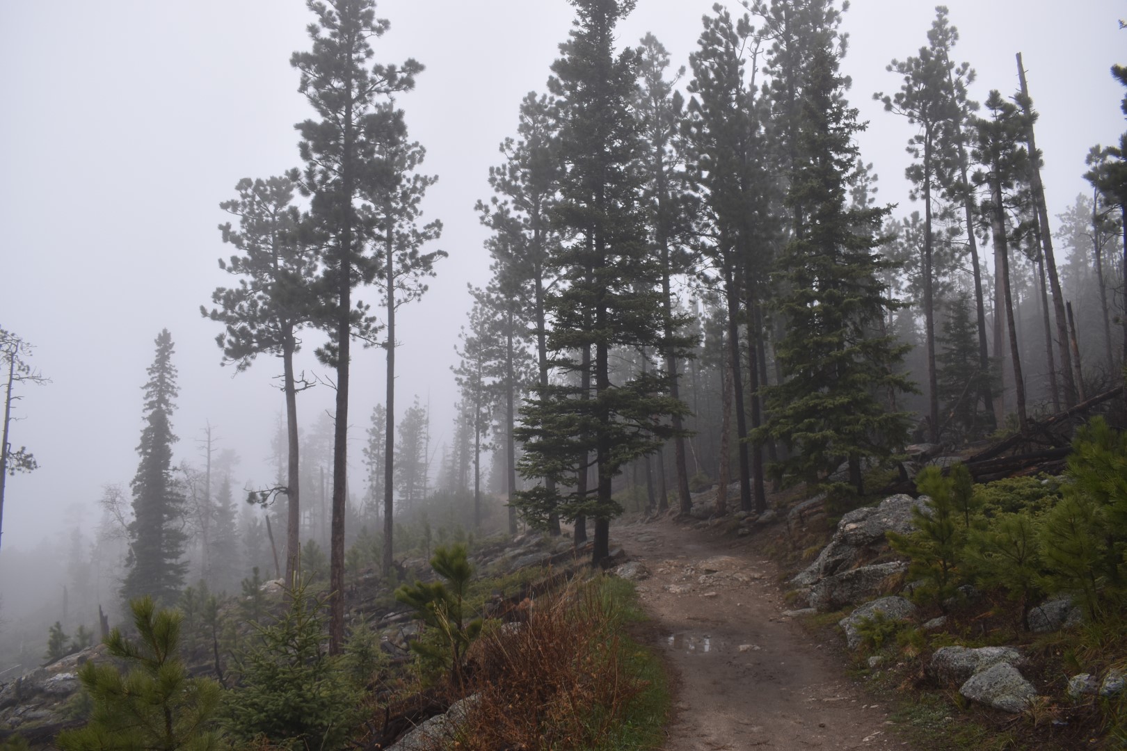
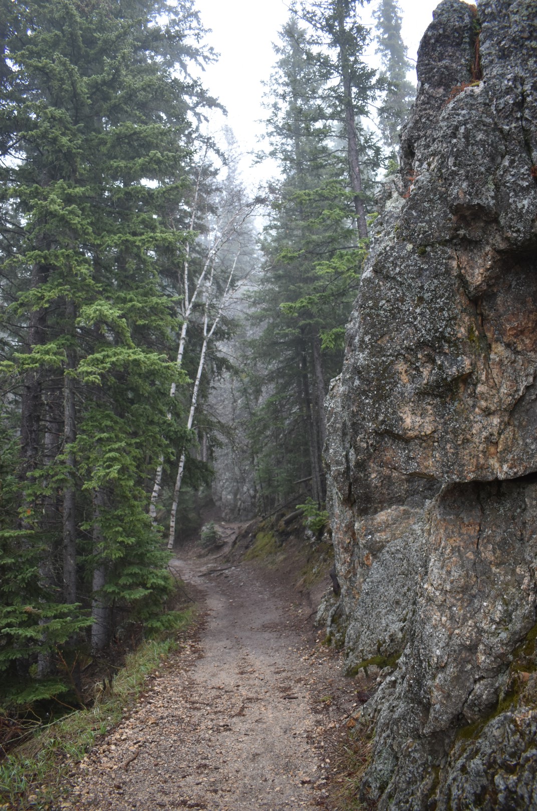
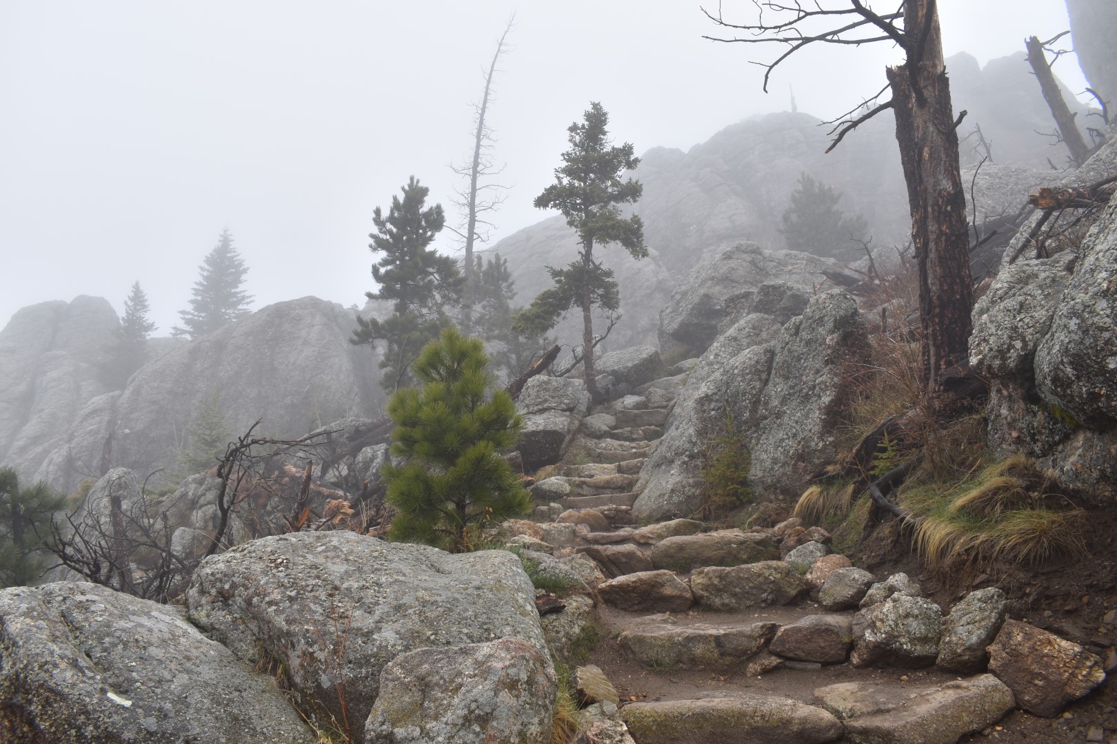
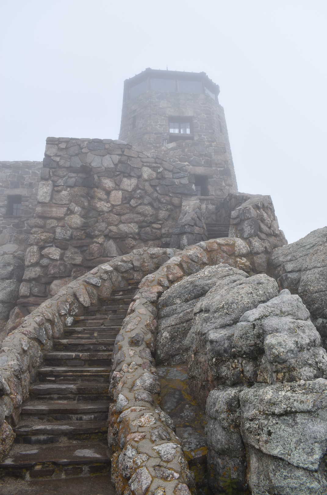
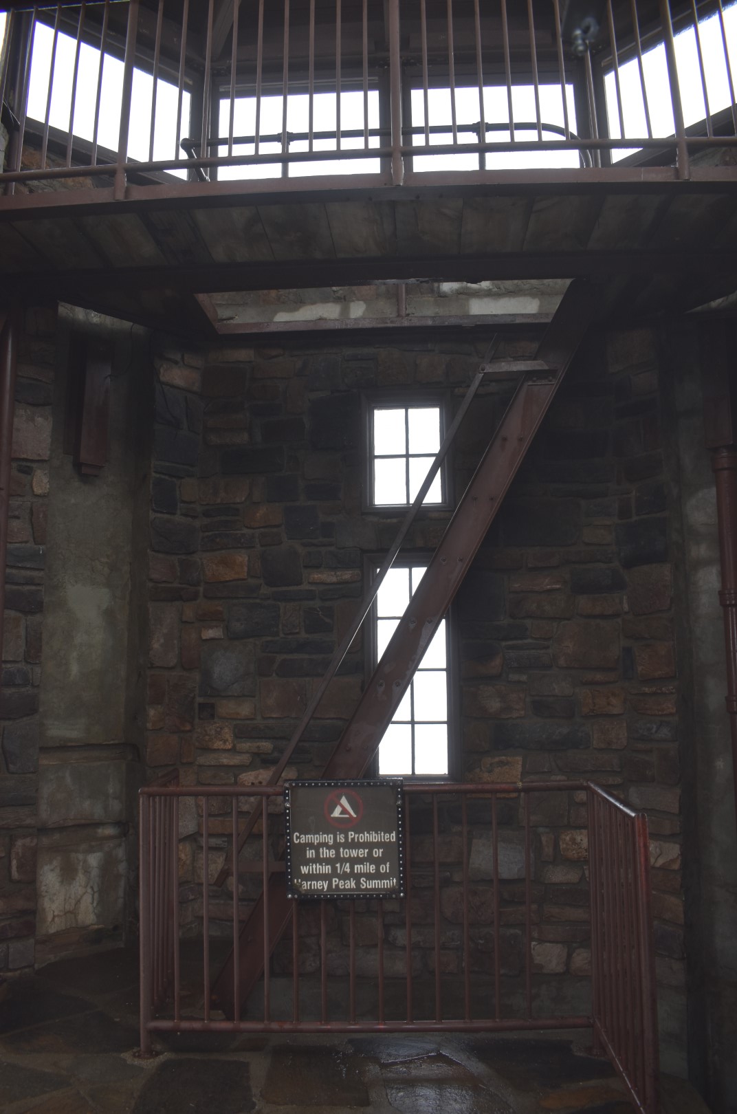
The trail worked its way through the forest and up and over a ridge before descending to the wilderness boundary. After that it was all uphill, though the grade was moderate. As we approached the summit, the trail left the forest and circled around the rock outcroppings. The final push to the top was the steepest yet. A series of stone steps and metal stairs had been installed to navigate the rocky terrain to the fire tower.
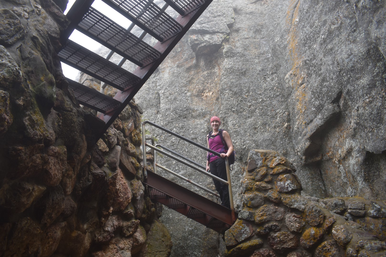
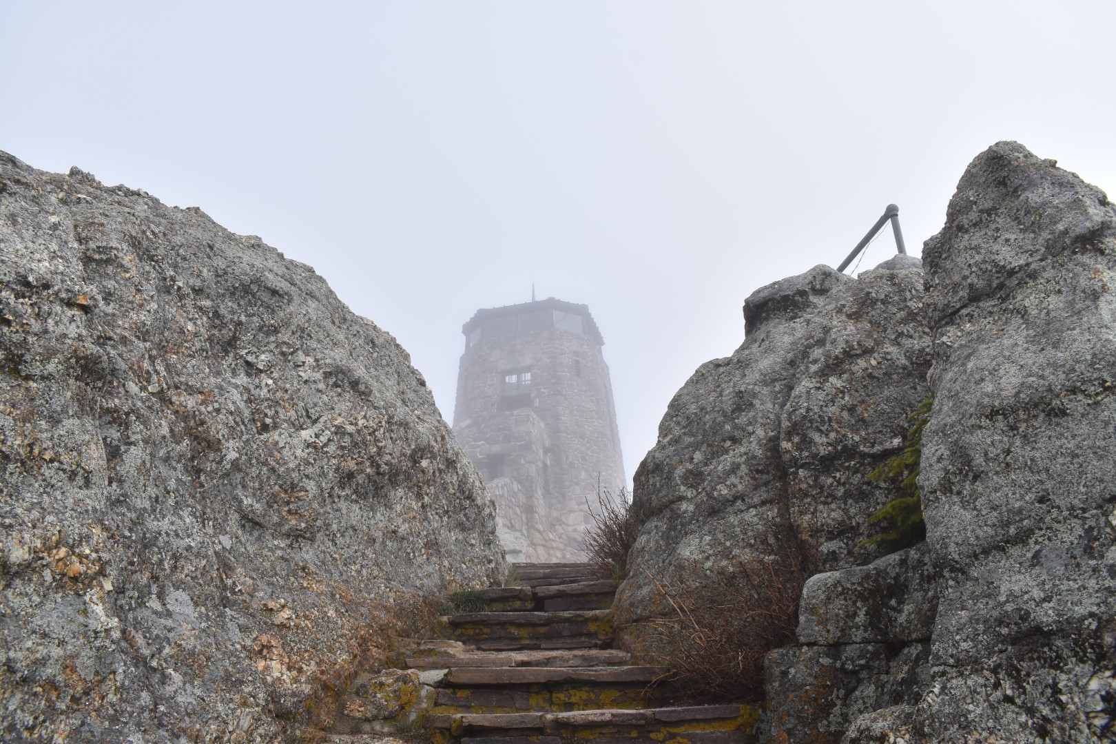
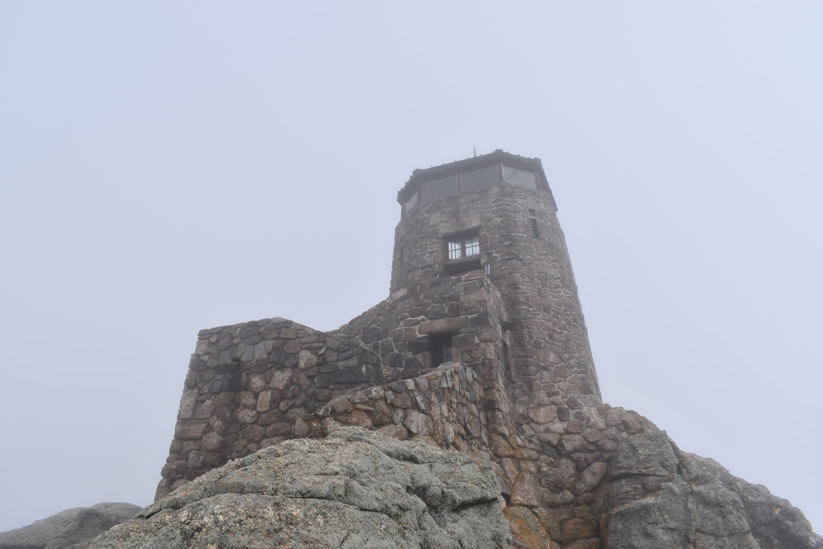
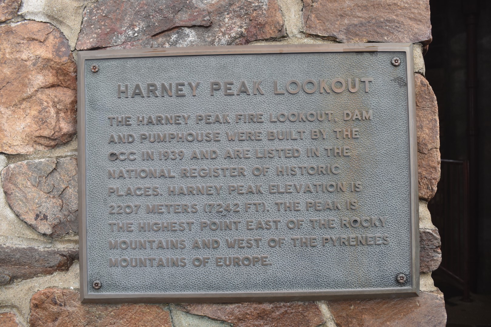
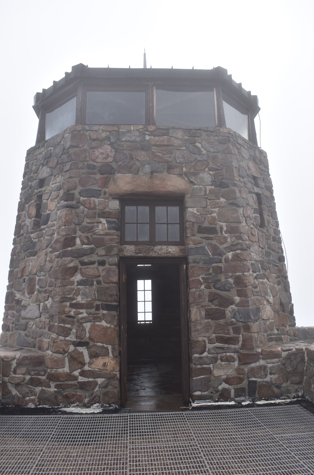
The fire tower (known as the Harney Peak Lookout) was built in 1939 by the Civilian Conservation Corps (CCC). It was used as a fire lookout until 1967 and added to the National Register of Historic Places in 1982. Today, the tower and surrounding structures are open to exploration. We were even able to climb the sketchy staircase to the upper lookout deck, though we of course saw absolutely nothing.
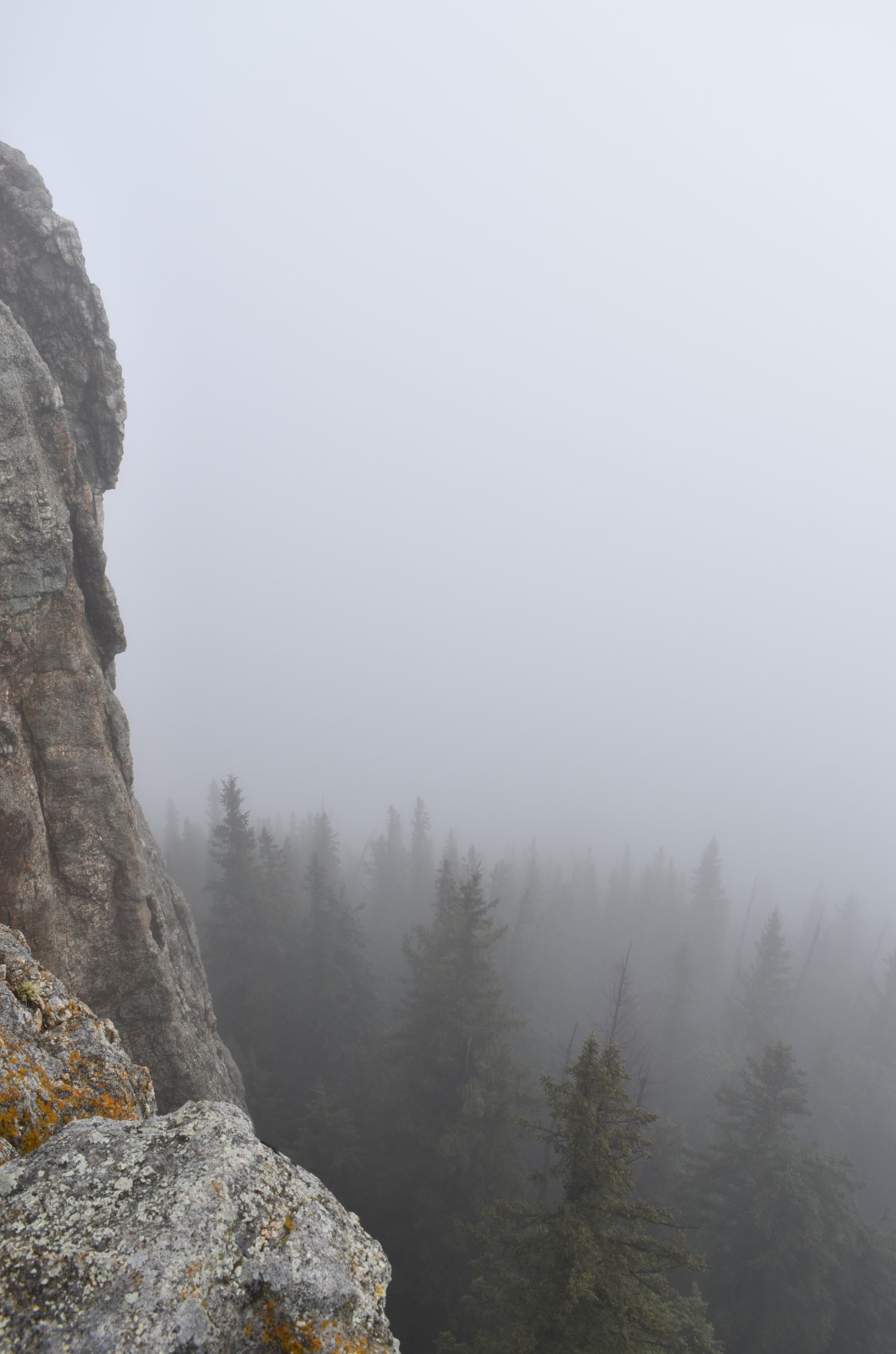
This is a pretty unique state high point, one that I would gladly repeat on a clear day. Apparently you can see four states from up there! And of course the surrounding Black Hills were surely stunning under their blanket of fog.
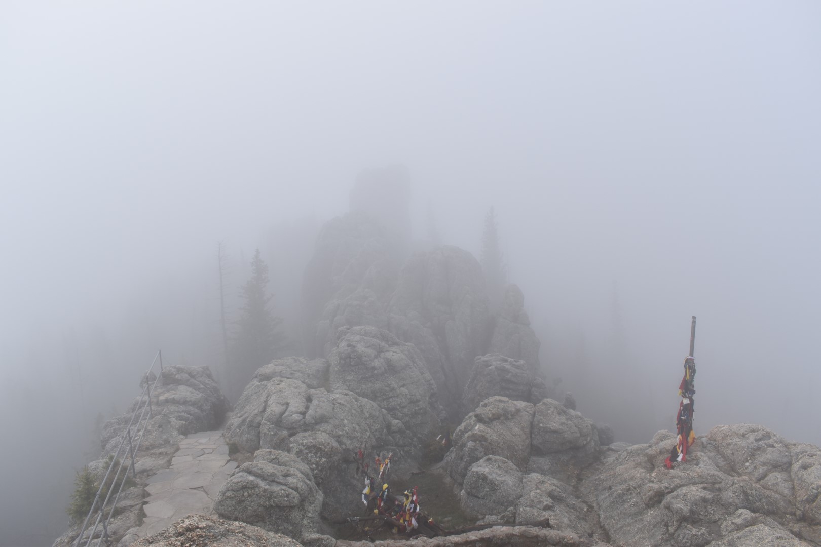
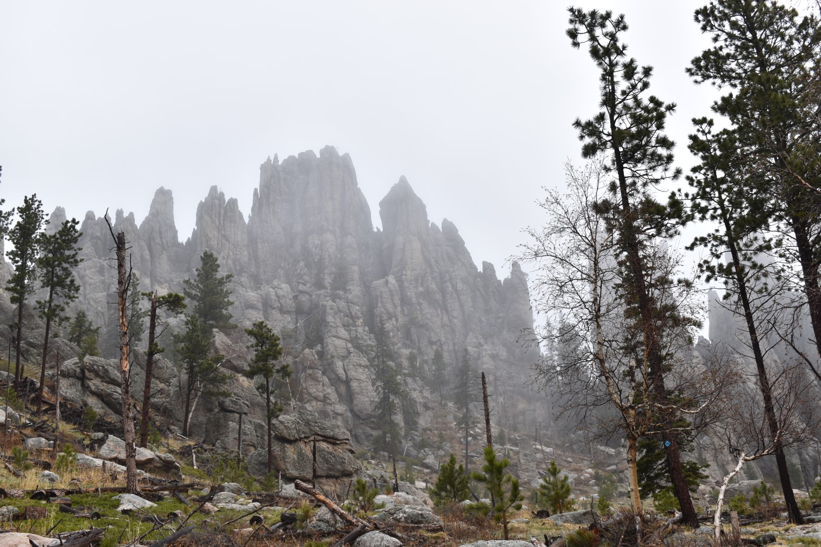
On the way back down, we took the #4 Trail. This trail has a similar grade to the #9 Trail, but is slightly longer. A few short spur trails depart from the #4 Trail and lead to various points of interest. We chose to visit the Cathedral Spires, which added about 1/2 mile and a steep 100′ climb back to the #4.
When we reached the Cathedral Spires, we were disappointed to find them obscured by fog. Add in the screaming children and we weren’t happy campers. But regardless, we stopped for a snack break and miraculously, the fog lifted while we ate. Soon we were able to see the spires clearly and get some awesome shots.
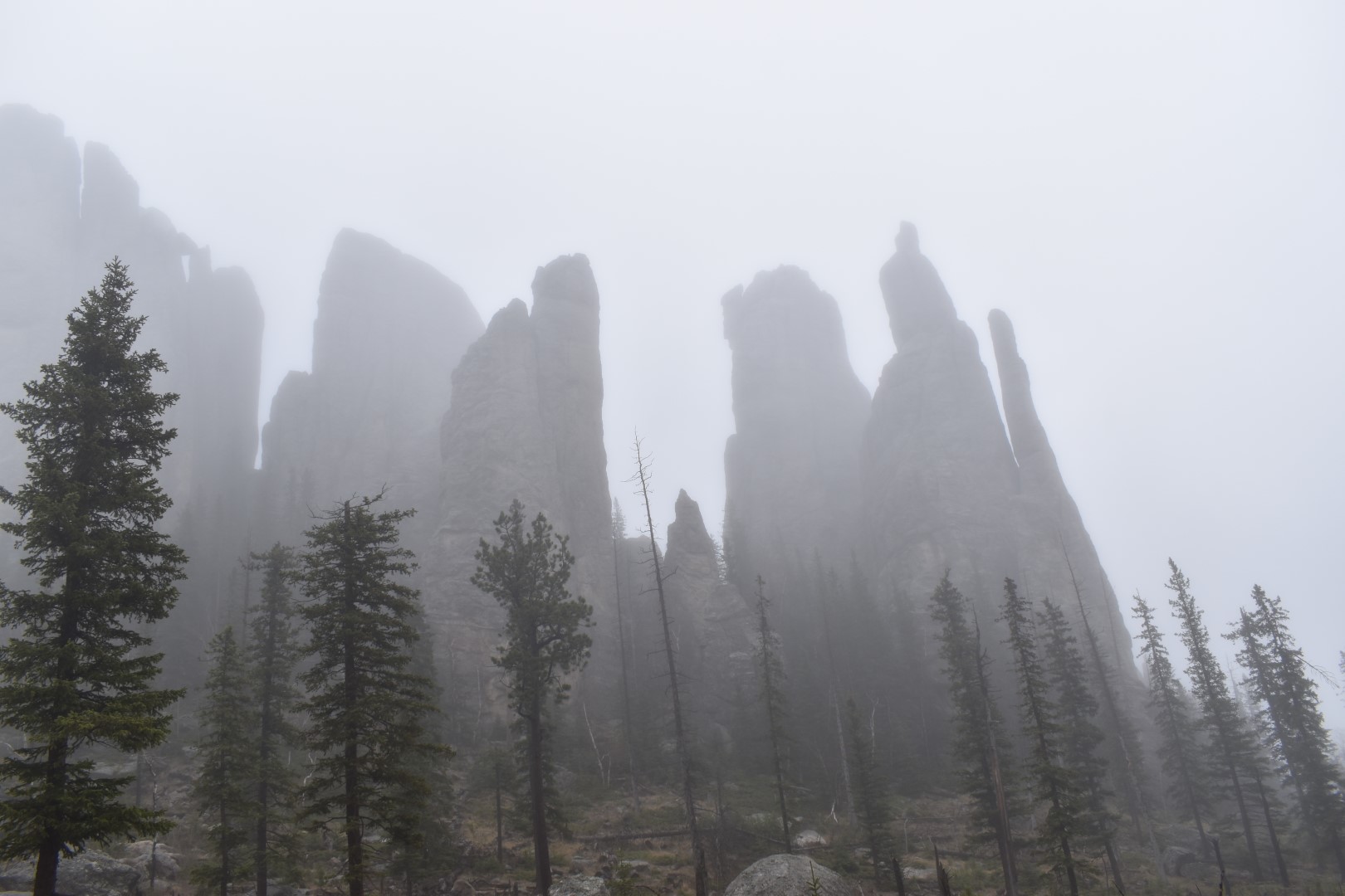
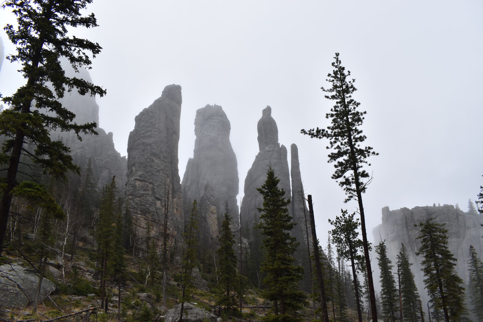
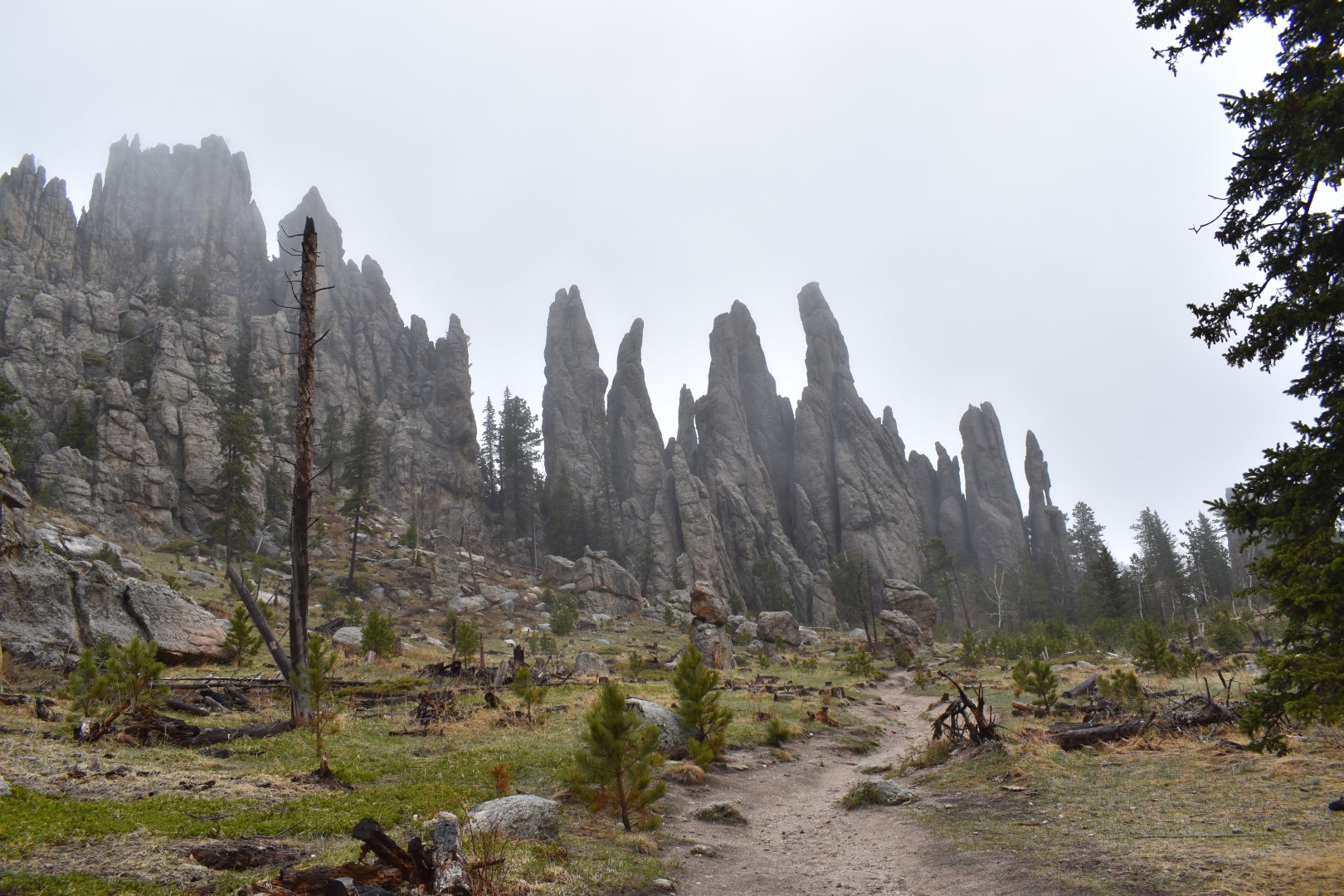
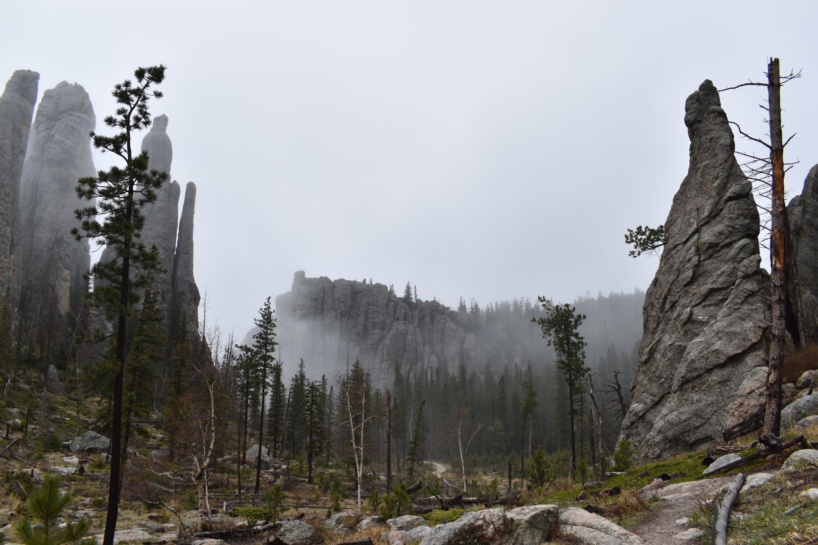
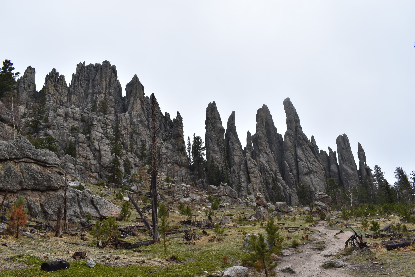
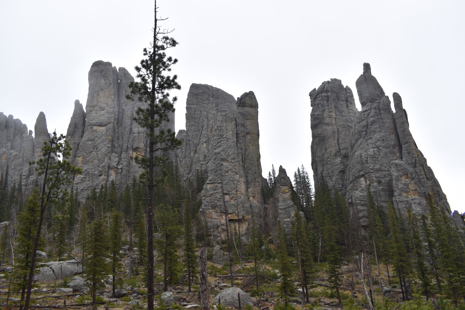
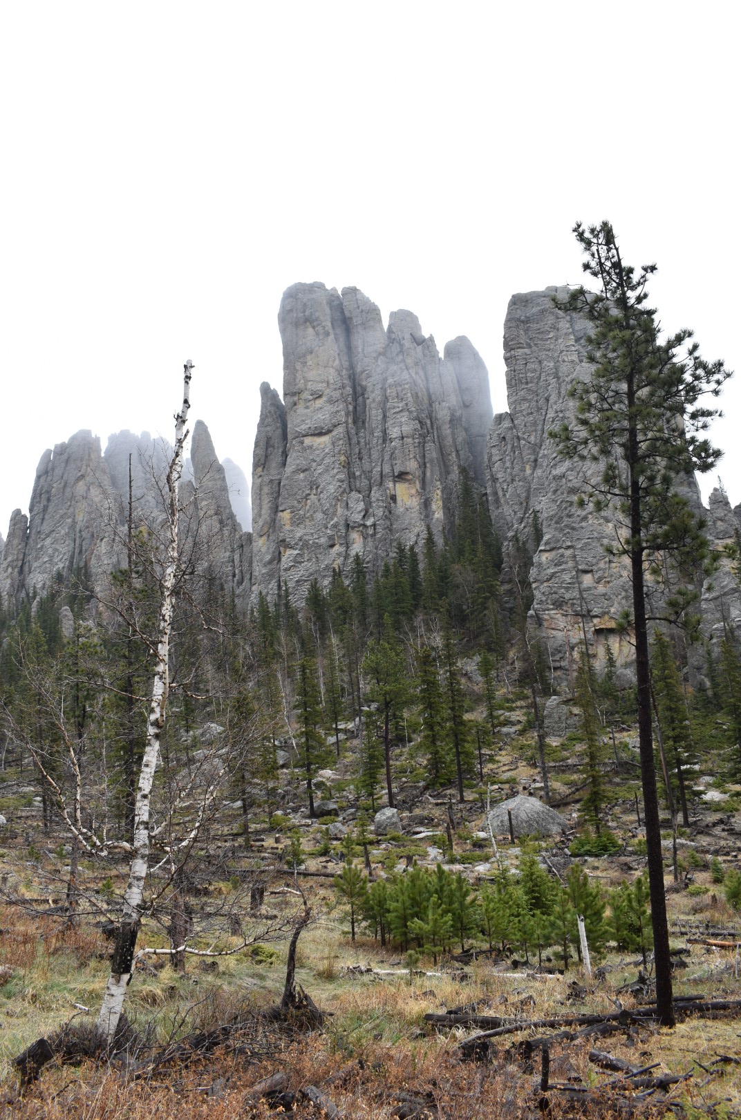
We spent way too much time watching the fog swirl around the spires, but eventually we tore ourselves away and continued back to the trailhead. The remaining trail was uneventful, though it was getting super busy. An early start was worth it just to avoid the crowds! We’d seen only a few people our entire ascent, and probably hundreds on the way down. Once back at the car, we regrouped and prepared for our planned afternoon touring the rest of Custer State Park.
I would like to acknowledge that Black Elk Peak is on the ancestral land of the Očhéthi Šakówiŋ (Great Sioux Nation) and Cheyenne.
Chelsea

Pingback: White Butte (3,506′) | North Dakota’s State High Point | 05/21/21 – Colorado Chelsea
You two seem to have a thing for fog & gumbo (at least on this trip). 😉 We did this exact same hike 2 years ago and – unlike you – had mostly clear skies. It’s interesting to watch the fog swirl but a clear view from the old lookout is a real plus.
LikeLike
We were very unlucky with weather on this trip! I’m just glad we were able to do both high points and the other handful of things we really wanted to do. We couldn’t see anything, but getting stuck in the hotel due to rain would have been much worse! I would have really enjoyed the view from the lookout, but now I have a good excuse to go back 🙂
LikeLike
Sorry you didn’t have a clear day for Black Elk Peak! It’s definitely worth a return trip. I wasn’t able to do many, but this was my favorite South Dakota hike. I love your hiking blog btw, and hope to visit a few of the spots you mention some day!
LikeLike
Thank you so much Lori! We weren’t able to do any other South Dakota hikes on this trip, but I’m sure I’ll be back one day to do some more!
LikeLike
I guess you did not hike this peak for the valley views. Still, hiking in the mist can be a real treat, as long as it is not too thick. Thanks for sharing Chelsea. Alaln
LikeLike
The mist provided a unique experience, that’s for sure!
LikeLike
I love those foggy mystical hikes!
LikeLike
It was pretty cool, but I still prefer clear days 😉
LikeLike
I understand your disappointment re the fog. I also want to say I think those fog-enshrouded photos are beautiful! I’m glad it cleared and you got to see a bit better. Boo to the crowded trails, though.
LikeLike
Thanks Tracy! It was so cool watching the fog lift around the Cathedral Spires. I couldn’t believe our timing!
LikeLiked by 1 person
Somehow I didn’t associate fog with the Dakotas. I’m glad you were able to get a few fog-free views. So sad to learn about another massacre of America’s First People.
LikeLike
We must have visited during the rainy season. It thunderstormed every night and was foggy every day. I had never heard of this massacre before. Of course I knew there was a reason the name was changed from Harney Peak, but I wasn’t sure exactly why. Sad to learn but I think it’s important to share.
LikeLiked by 1 person
I agree. Learning about history has to be inclusive and address everything, the good, the bad, and the ugly…
LikeLiked by 1 person
Sorry to hear that you had to deal with more fog and that it obstructed the views. I’m glad it somewhat cleared enough for you to see the Cathedral Spires as they look quite impressive.
LikeLike
The Cathedral Spires were super cool! Well worth the little extra effort.
LikeLiked by 1 person
Laughing about the screaming kids. lol. Great pics and adventure even with the fog!
LikeLike
I’m always amazed what parents let their kids do when others are around…oh well lol. I do like how many of the foggy pictures turned out, and we still were able to summit so I can’t complain too much 🙂
LikeLiked by 1 person
Despite the fog you did capture some magical pictures!
LikeLike
Thank you Laci!
LikeLiked by 1 person
This is so cool! Now i want to go!
LikeLiked by 1 person
Also- everything by CCC seems to be pretty great- that tower is no exception- love it!
LikeLike
They were sure involved in some cool projects!
LikeLiked by 1 person
Oooh those spires are so cool!
LikeLiked by 1 person
Thank you for the tour and your great photos. I’d like to visit Black Elk peak. So glad the name has been changed from Harney Peak, which must have been a very painful name considering the history. I adore CCC stone work. Hope we can go a day without fog!
LikeLike
Thanks Rebecca! I hope that it’s a nice clear day when you’re able to make it to Black Elk Peak!
LikeLiked by 1 person
Pingback: Custer State Park Scenic Loop | South Dakota | 05/22/21 – Colorado Chelsea
Too bad about the fog but it did make the pictures really interesting and different. Maggie
LikeLike
I would have liked to have views from the top, but the fog did add some interest to the pictures, and I enjoyed watching the fog swirl around the rock spires.
LikeLike
I have recently been to a Fire Lookout well East of San Diego, as well as I have been around some in the PNW, but none of them looked like the beautiful one you were at. The rock spires were also fascinating. Even though you didn’t get the view you wanted, because of the weather, it was still a very cool hike with a moody vibe. .
LikeLike
I’ve only been to a couple fire lookouts, but this was definitely one of the cooler ones! I do wish we’d had the views this peak is known for, but I think the fog made it look a lot more mysterious.
LikeLike
Great post! This hike is on our itinerary for the summer!
LikeLike
It was awesome! Hopefully you have a clear day
LikeLiked by 1 person