
Red Mountain Loop | Red Mountain Open Space
Wellington, CO | 04/18/21 | 7.78 miles | 899′ gain

I’ve come to enjoy my winter hikes at Red Mountain Open Space. This would be my third visit and the last one needed to have hiked every trail. Most people probably wouldn’t think to head to the Colorado/Wyoming border for a hike, but Red Mountain and the adjacent Soapstone Prairie offer miles of multi-use trails through prairie, red rock canyons, and even onto the Cheyenne Rim.
I was able to convince Diana to make the long trek north and the seemingly even longer trek down dirt roads to get to Red Mountain. (It’s quite literally in the middle of nowhere.) She had never been there before so I took the liberty of devising a loop that would give her a taste of Red Mountain and also allow me to finish up the last few trails I had remaining.

From the trailhead, we hiked west on the Bent Rock Trail. After 0.3 miles, the Bent Rock Trail splits; the right (west) fork heads into a red rock canyon and the left (south) fork loops around the canyon to the south. After a quick peek into the canyon, we returned to the intersection and followed the south fork into unknown territory.
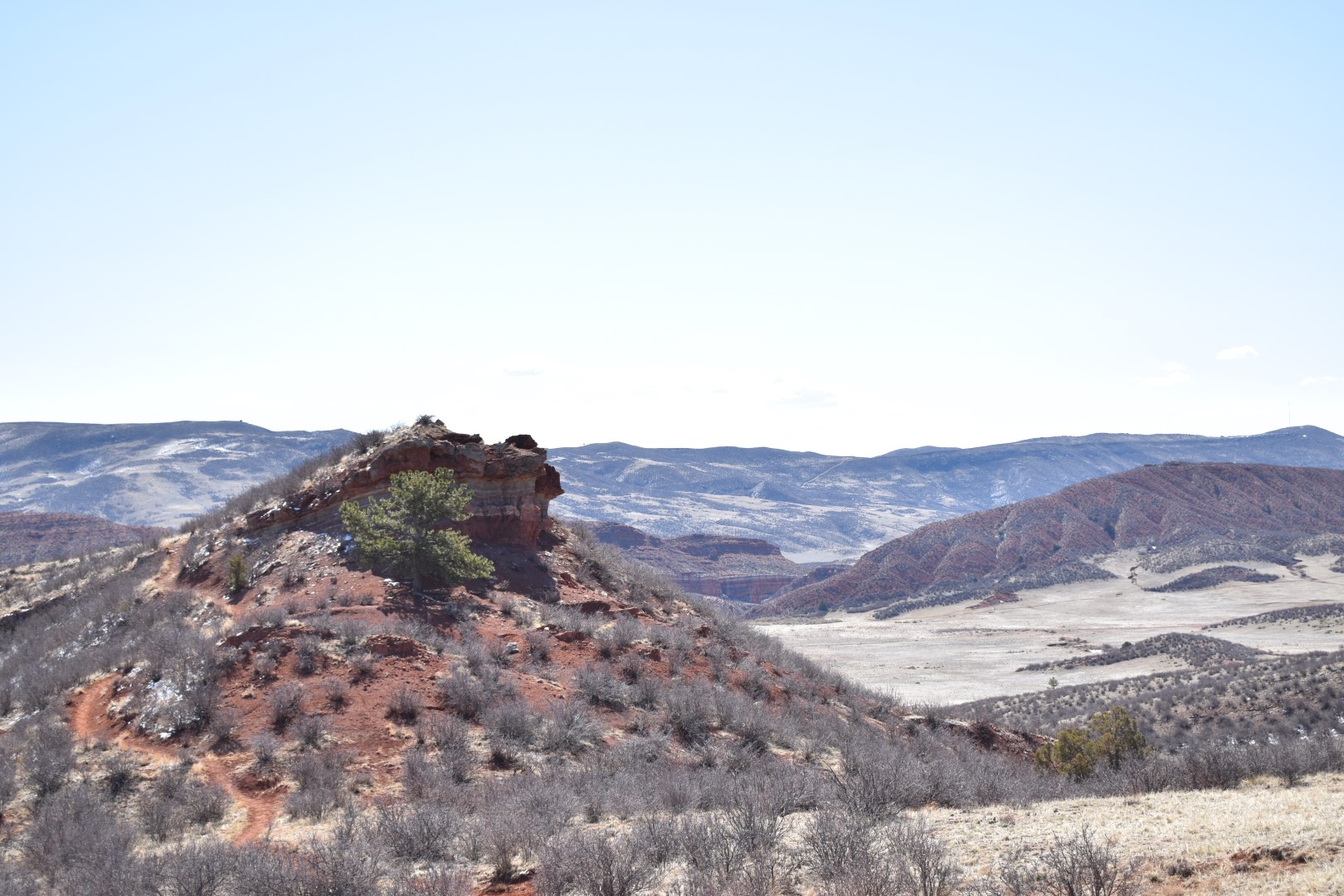
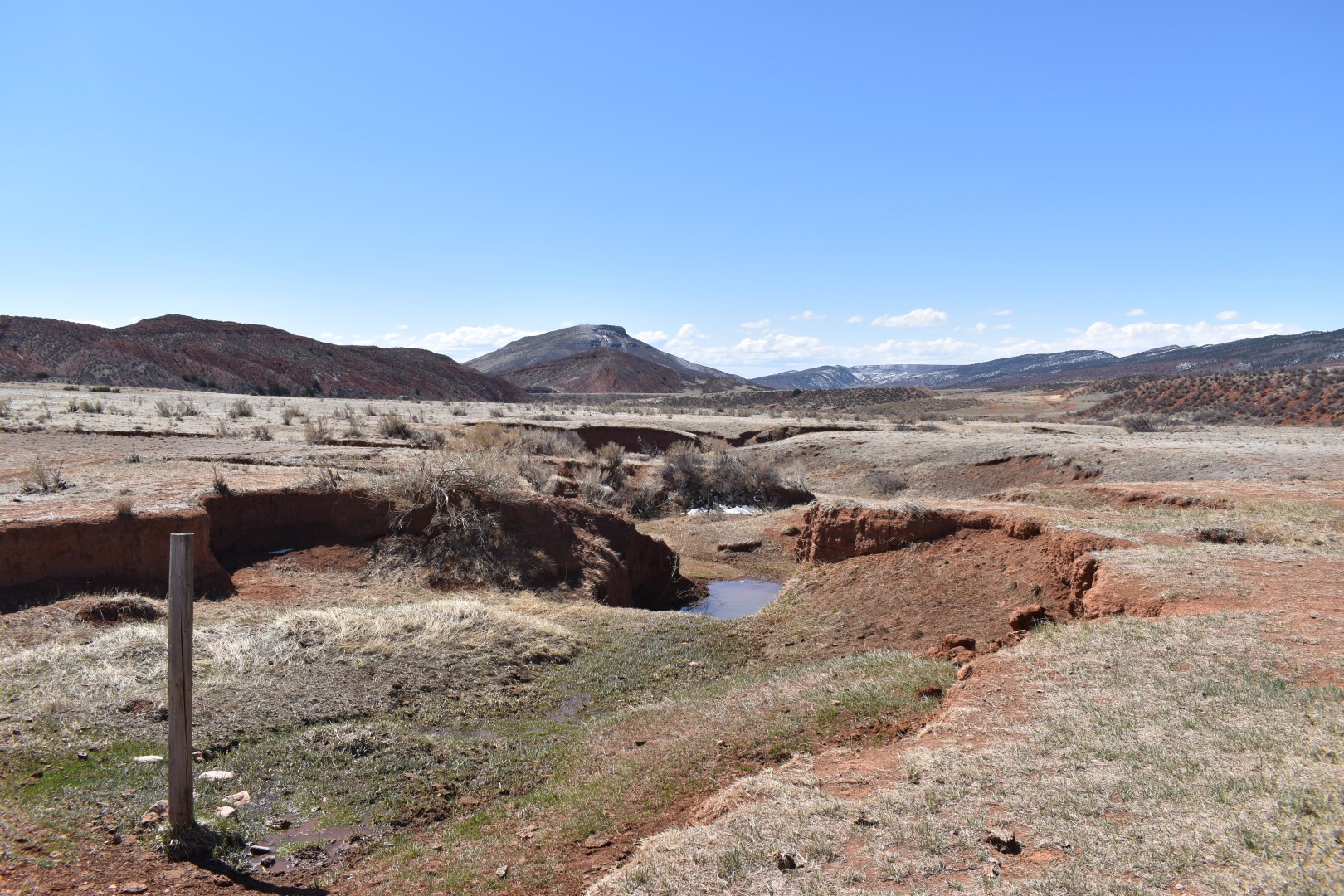
The south fork of the Bent Rock Trail loops down and around the low mountain that forms the south wall of the canyon. Because we were bypassing the canyon, I assumed (wrongfully) that we would have a terribly boring journey. I was surprised to find more of the park’s iconic red rock formations as well as good views of Table Mountain to the south and the main part of the park to the north.


The trail looped around the west side of the mountain and met back up with the main trail after 2.0 miles. We turned left onto the Ruby Wash Trail and after just 0.3 miles, we took another left onto the K-Lynn Cameron Trail.


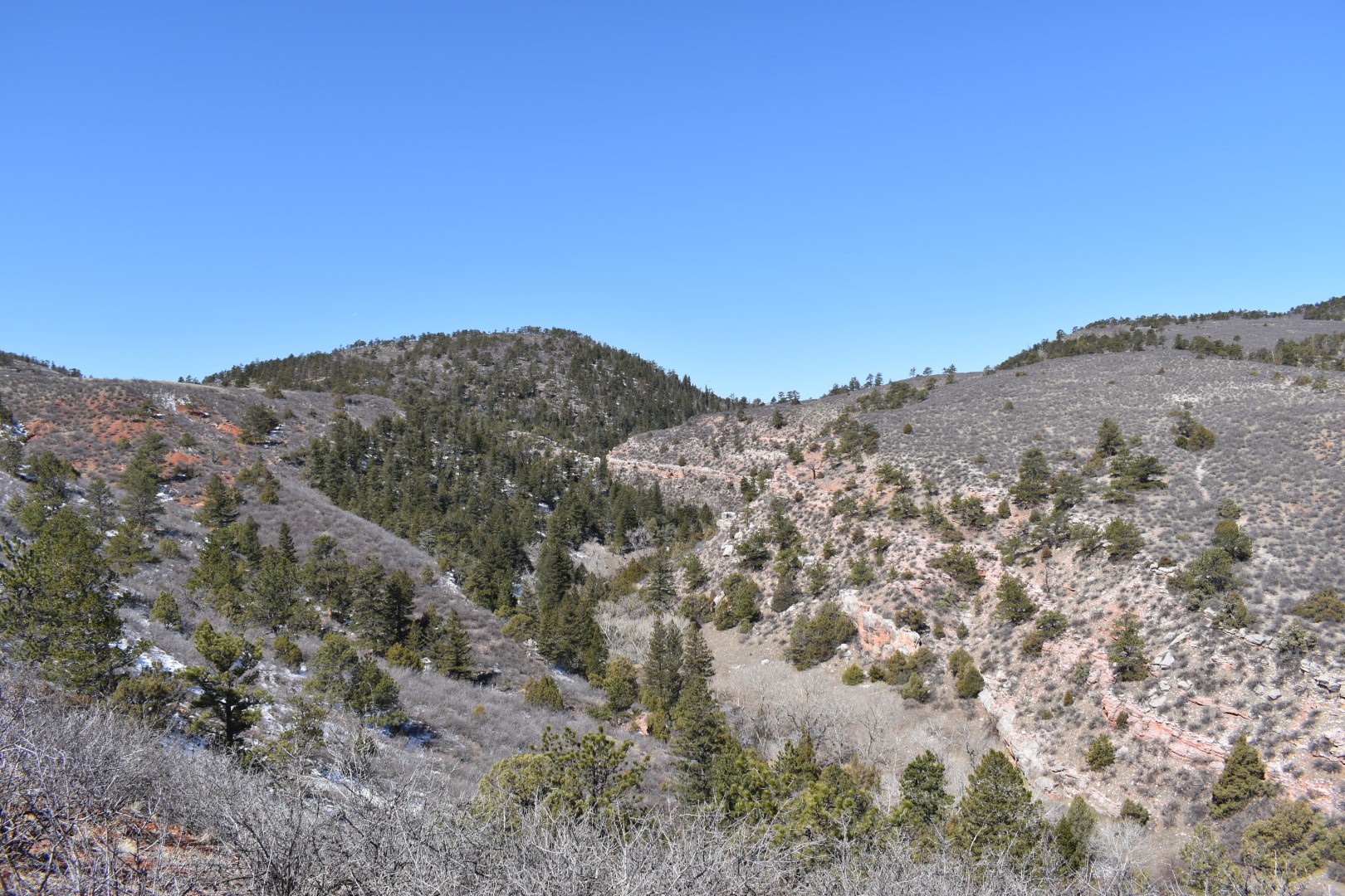
The K-Lynn Cameron Trail took us up into the hills west of the Big Hole. The trail marked the transition between the red rock/scrubby grassland to the east and the forested foothills to the west. The views here were the best of the day.


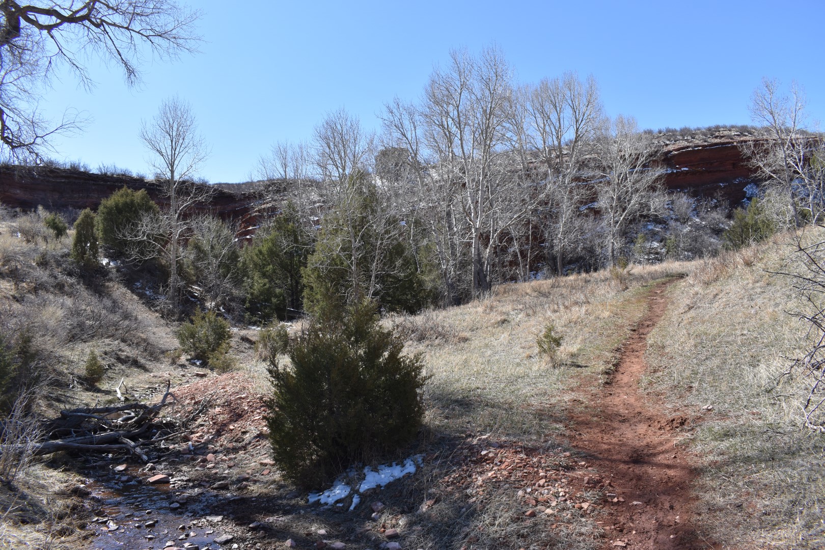
After 1.5 miles, we descended a series of tight switchbacks down to a small unnamed creek fringed with cottonwoods. There wasn’t much water flowing but it did provide a lovely change in scenery as we followed the creek down to the stone circles and the shepherd/cowboy cabins.


A short spur trail leaves the K-Lynn Cameron Trail to visit the stone circles and the cabins. There are interpretive signs along this spur telling of this area’s human history.

The stone circles were built by Indigenous people to anchor their tepees and structures. The rocks were used to weigh down the hides and could be moved to the side when the group moved to their summer camp. Hides and poles were cached nearby and the structures were re-pitched in the stone circles upon their return in the winter. This particular camp has a number of stone circles, only a few of which are obvious to the untrained eye. It seems that this was a good camp location due to its proximity to water, edible plants, and ridges and arroyos that provided cover from the elements.

The cabins were used by shepherds and cowboys working for the Warren Livestock Company. The company apparently pioneered some new ranching techniques here, such as running sheep and cattle on the same pastures. Francis E. Warren, the owner of Warren Livestock, was Wyoming’s first governor and later a US senator.

Shortly after leaving the cabins, we reached an intersection with the Ruby Wash and Big Hole Wash Trails. We continued straight onto the Big Hole Wash Trail for 0.8 miles and then took a right onto the Sinking Sun Trail, which took us back to the trailhead.
It was a little bittersweet to finish up the trails at Red Mountain, but I know I can always come back to do a repeat or two.
I would like to acknowledge that Red Mountain Open Space is on the ancestral land of the Očhéthi Šakówiŋ (Great Sioux Nation), Cheyenne, and Arapaho.
Chelsea

Your collection of trail descriptions & photos is priceless! And would be a source I would read before every hike, if I lived in Colorado! 🙂 That many photos would make a paper book too expensive, but maybe an electronic one? Or an easy-to-find online index of all the trails you’ve described for hikers to click and read about a trail before going. A really valuable resource! Thanks for the work you’ve put into it!
LikeLiked by 1 person
Thanks Charlie! I do have a few menus on my website: https://colorado-chelsea.com/
The righthand menu is probably the one closest to what you’re looking for. I have every hike (at least the ones I’ve written about) sorted by location.
LikeLiked by 1 person
Oh geez, I forgot about this hike… and the peeing deer 😂 I’m also now remembering the baby cows!
LikeLike
Aww I forgot about the baby cows!!
LikeLiked by 1 person
I’ve always wanted to explore Colorado!! This looks like a hike I would love!!
LikeLike
Red Mountain is a pretty cool area! Not the typical place tourists gravitate to (Colorado has so many beautiful places that it’s hard to choose!) but maybe that’s a good thing!
LikeLiked by 1 person
This looks like a lovely hike. I love how red the soil is. The cabins looks pretty neat too.
LikeLike
I always enjoy seeing cabins or really anything historically relevant. The stone circles didn’t show up well in photos, but they were cool to see in person!
LikeLiked by 1 person
Great photos, informative history, and is there any better vista than “endless red rocks?!” Thanks for sharing.
LikeLike
Thank you! 🙂
LikeLike
Love your posts Chelsea – your scenary is so different to ours in the UK, but it’s the same buzz getting out there amongst it all!
LikeLike
Thanks Paul! Colorado has a lot of varied scenery, there is always something new to see!
LikeLike
Love how you go into the history of the area rather than just focusing on the natural beauty (even though it is pretty)!
LikeLike
Thank you Tressa! I love the combination of history & nature.
LikeLike
Love this! I loved the cabin photo! For some reason I love these old
Buildings and their history!
LikeLike
Me too! It’s always a plus when I can visit historic sites on my hikes.
LikeLiked by 1 person
The landscape looks fascinating, Chelsea. It’s a little far from Colorado Springs to Red Mountain OS, but if/when we travel next to Wyoming, we will try to explore it. Thanks for introducing us to the different loops.
LikeLike
It’s worth a stop if you’re heading up that way! Probably not worth a special trip, especially when you have Garden of the Gods in your backyard 🙂
LikeLiked by 1 person
I will definitely add it to our wish list!
LikeLiked by 1 person