
Mount Edwards (13,850′) | CO Rank: 83/637
McClellan Mountain (13,587′) | CO Rank: Unranked
Front Range | Arapaho National Forest | Georgetown, CO
09/19/20 | 5.21 miles | 2,488′ gain | Class 2
This is likely the shortest and easiest way to summit Mount Edwards and McClellan Mountain. Tori and I drove the Tacoma up to the Waldorf Mine, where there is a good-sized parking area. The road in is easy 4wd, but it is long. We were hiking by 8am.

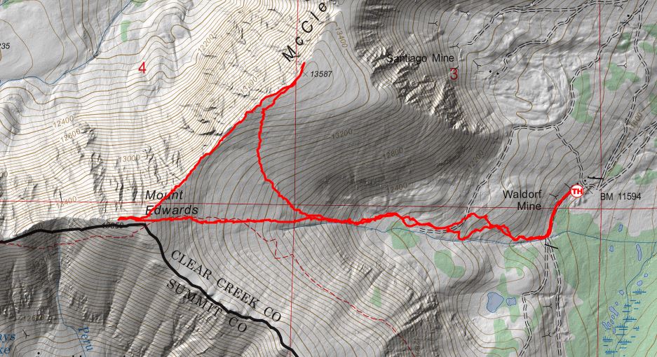
We continued on the 4wd road about 1/4 mile before turning right at a small stream. A faint trail started us out but soon disappeared as we hiked further into the basin on gently rolling terrain. The willows weren’t as bad as they looked and we were nearly able to avoid them entirely.


We picked up an old road towards the back of the basin that led to a mining area just below a Y-shaped gully. This gully was our exit from the basin onto Edwards’ east slopes.


We found the gully to be loose but manageable. An eroded trail led us through the gully and dropped us off on the gentle upper slopes.

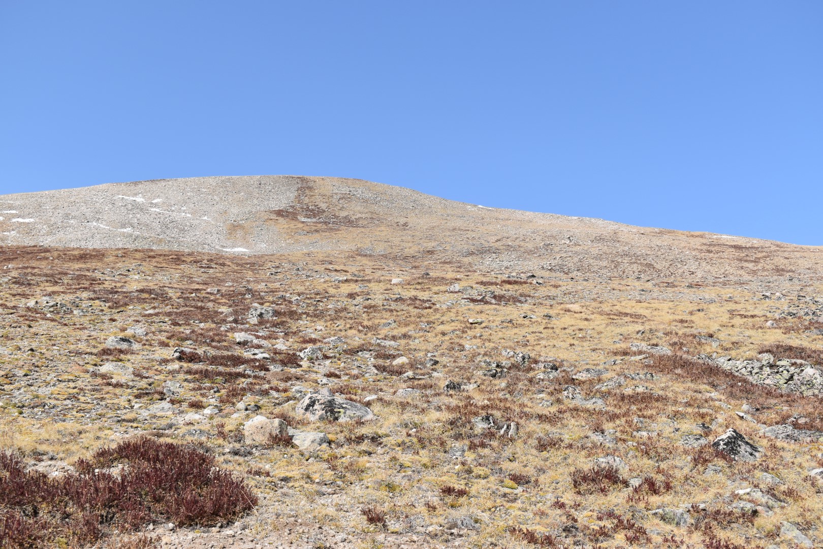
Although the upper slopes are more gradual, there was still about 1,000′ to gain in just 0.6 miles. It felt a lot steeper than it looked. We arrived on Edwards’ broad summit to a surprising number of people. Our route may be the shortest and easiest, but it certainly isn’t the most popular. With the exception of Edwards’ summit, we didn’t see a single other person the entire hike.


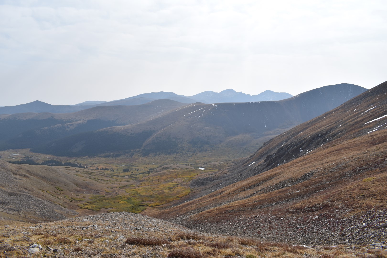
The views from Edwards were certainly worth the efforts but after a short break it was time to get moving. The second mountain of the day always looks higher than it is, but we only had about 200′ more to gain to get to McClellan. We followed Edwards’ northeast ridge directly to the saddle, and then up McClellan.

The ridge up McClellan took no time at all and we enjoyed peeking over the “edge”. We had the summit to ourselves.


To return to the truck, we hiked down McClellan’s south slopes before heading back into the Y-shaped gully and reconnecting with our ascent route.


Edwards and McClellan were my last two 13ers up Leavenworth Creek. It is bittersweet to finish up in an area I have loved since I first laid eyes on it years ago, but I’m sure I will think up some other reason to return again and again.
Chelsea

Just beautiful Chelsea. Thank you for sharing!
LikeLike
Thanks Helen 🙂 these two had particularly good views.
LikeLike
Great looking ridges…the sort I used to love walking. Do you get much by way of bog on the slopes of hills/mountains? It’s something we get quite a lot of here in Scotland – probably something to do with the rain. Lol
LikeLike
Not on the slopes, they tend to be pretty well-drained. We do get wet areas in flatter areas of the alpine, but these might be more seasonal flooding than true wetlands.
LikeLiked by 1 person
Looked like the hike up to the ridge line was a little challenging based on the topo.
LikeLike
It was a little steep through the gully but otherwise not terrible, just very steady gain.
LikeLike
Wow! Great photos. What a great hiking adventure.
LikeLike
Thanks Debie!
LikeLike
The views look beautiful. I have no idea how you were able to navigate the trail as the path doesn’t look very well defined.
LikeLike
A lot of trial and error mostly. We occasionally lost the trail but I always bring a map and have a general idea of where we’re supposed to go. I actually wasn’t expecting a trail at all!
LikeLiked by 1 person