
Saint Vrain Mountain (12,162′) | Indian Peaks Wilderness
Allenspark, CO | 08/06/20 | 9.2 miles | 3,268′ gain
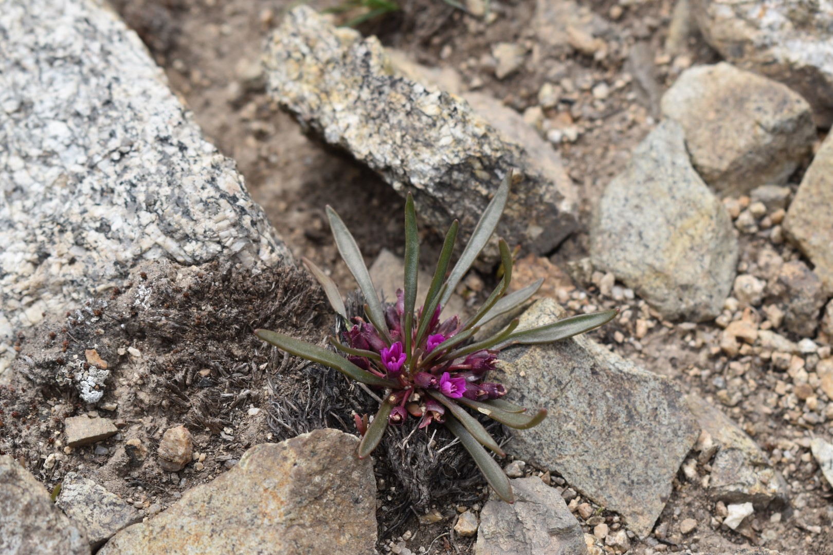
Saint Vrain Mountain is a low 12er that was recommended to me by an old coworker. I’d hiked along the trail a few times before but always happened to come on a day with too much snow or too much wind so I’d never summited. A failed peak is always in the back of my mind and I was waiting for a day I could return once again. Early August proved to be snow-free and while the wind is ever-present, it would at least be manageable.
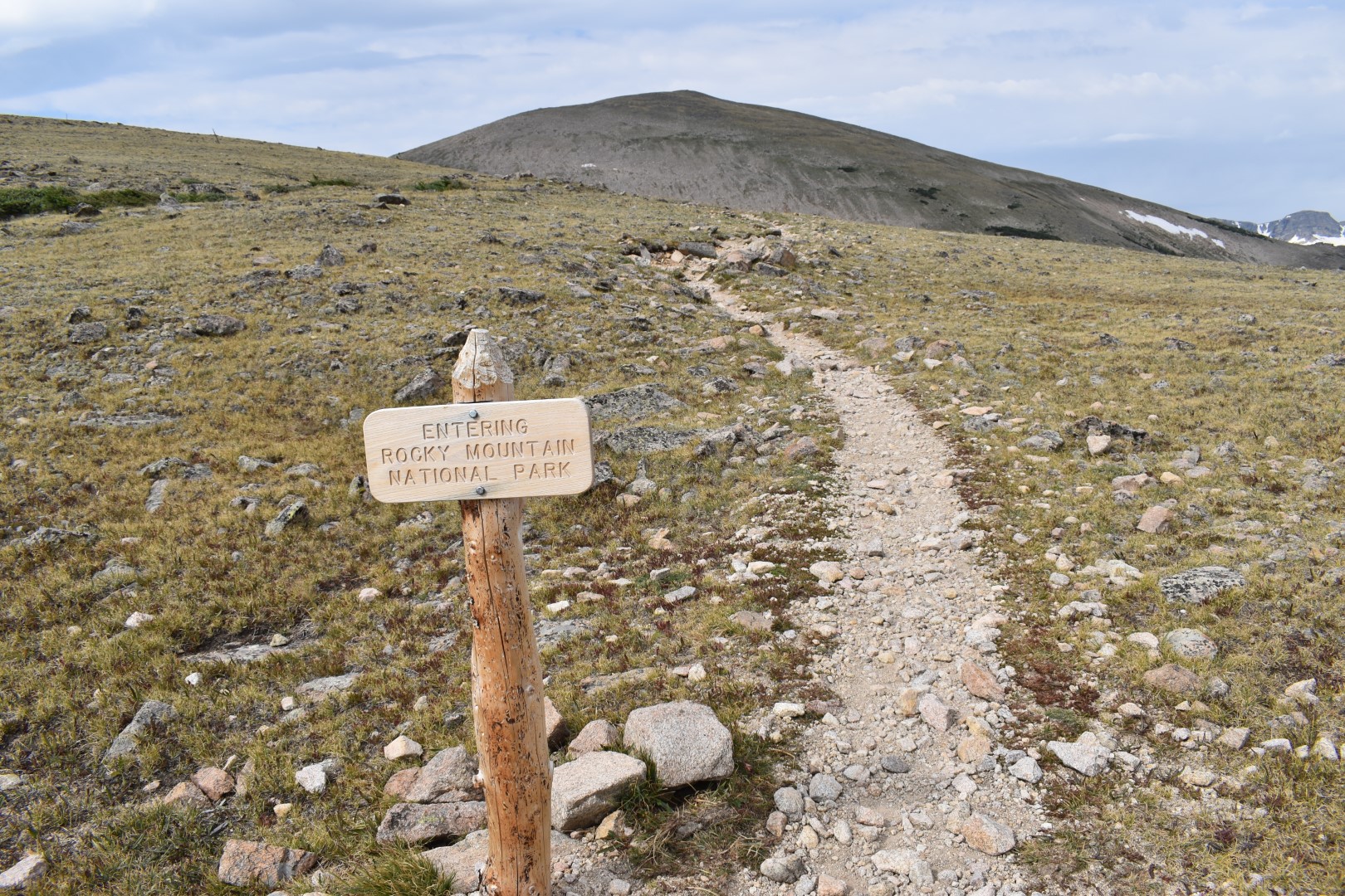
(There is some conflicting information online about whether or not dogs are allowed on this trail so I opted to leave mine at home just in case. Officially, per the USFS -dogs are not allowed on the short portion of trail that crosses into Rocky Mountain National Park. An alternative for those with dogs is not provided. There is a sign at the park boundary but it doesn’t have any regulations posted and plenty of dog owners either disregarded or simply didn’t know this rule. “No Dogs Allowed” in this case apparently falls into the “Know Before You Go” category.)
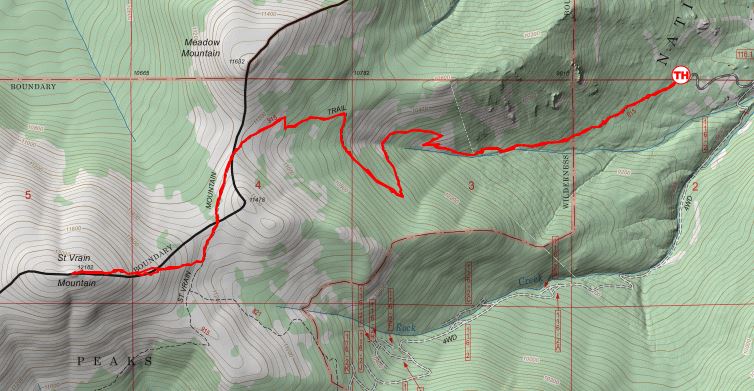
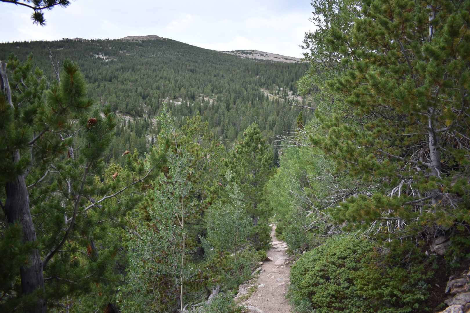
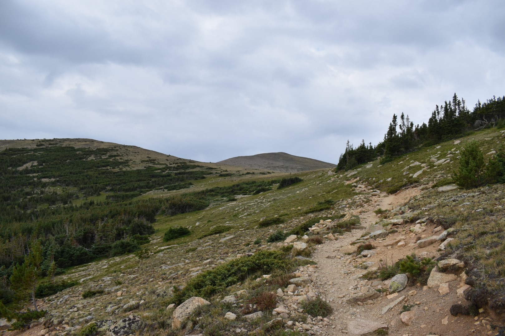
I arrived early to beat the afternoon thunderstorms, plus I needed to work a bit once I got home. Since it was a weekday, the small parking area was mostly empty. The Saint Vrain Mountain Trail starts in an aspen forest but soon transitions to pine and fir. It is a moderate but steady climb and I soon reached the Indian Peaks Wilderness boundary.
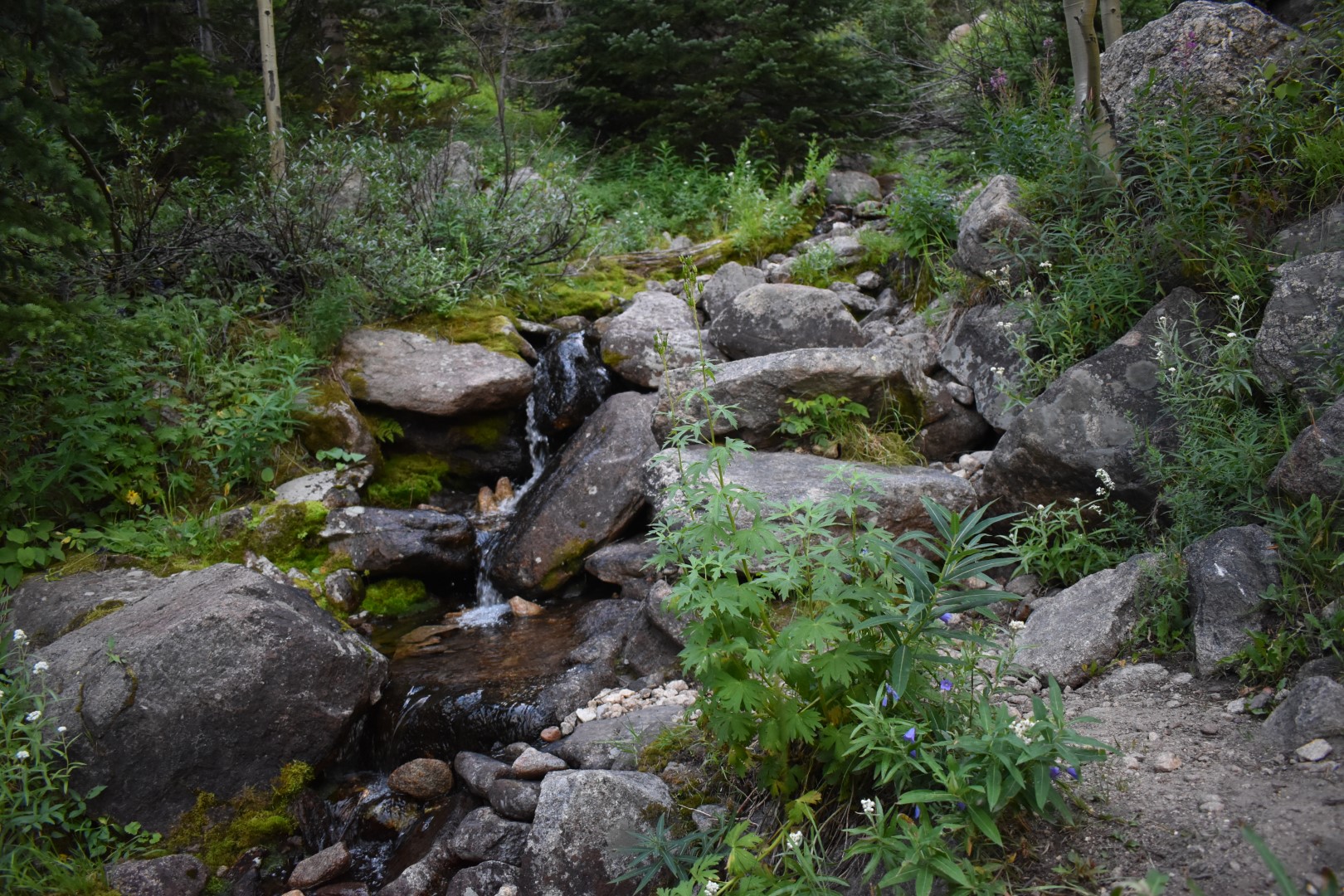
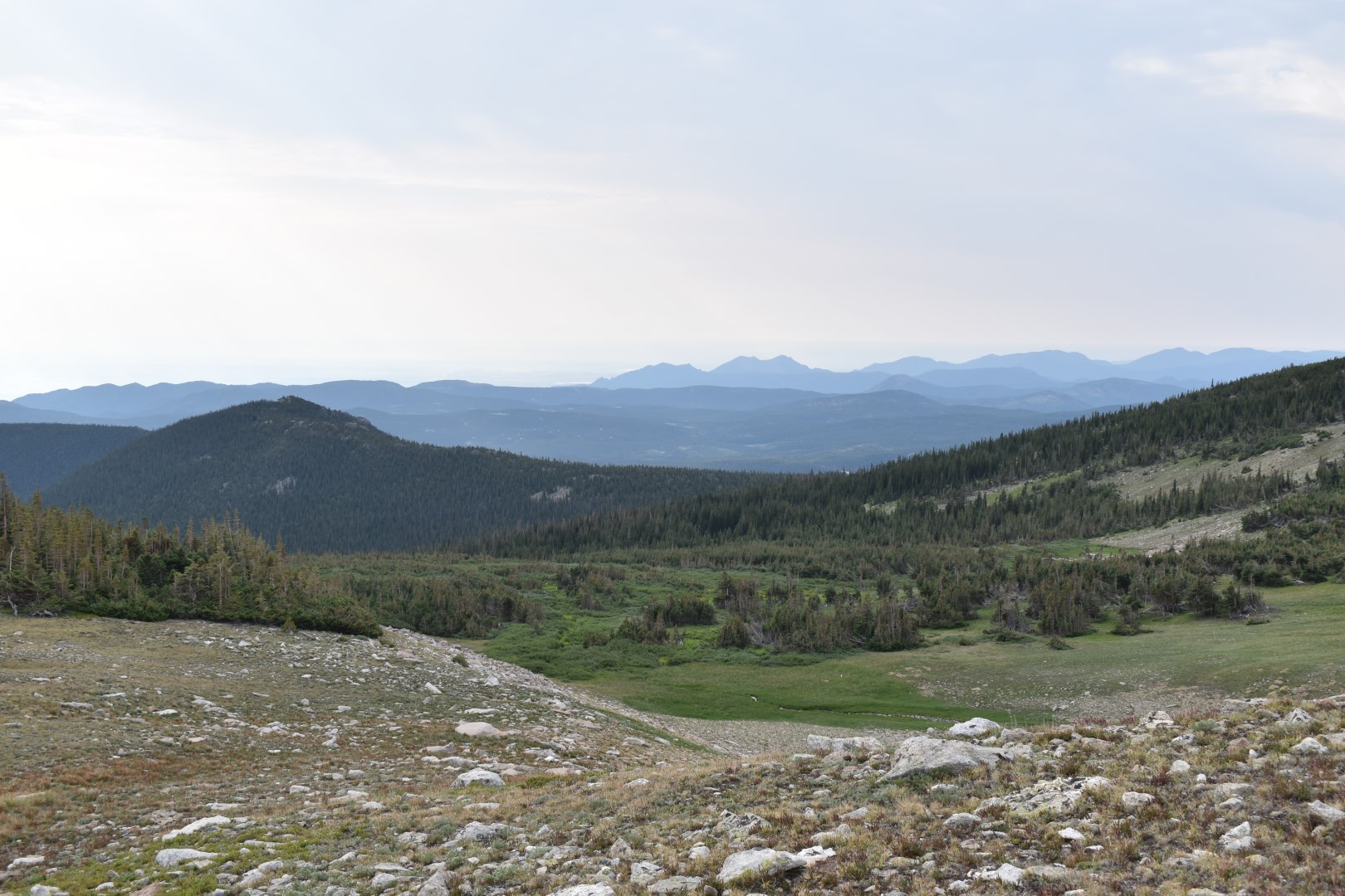
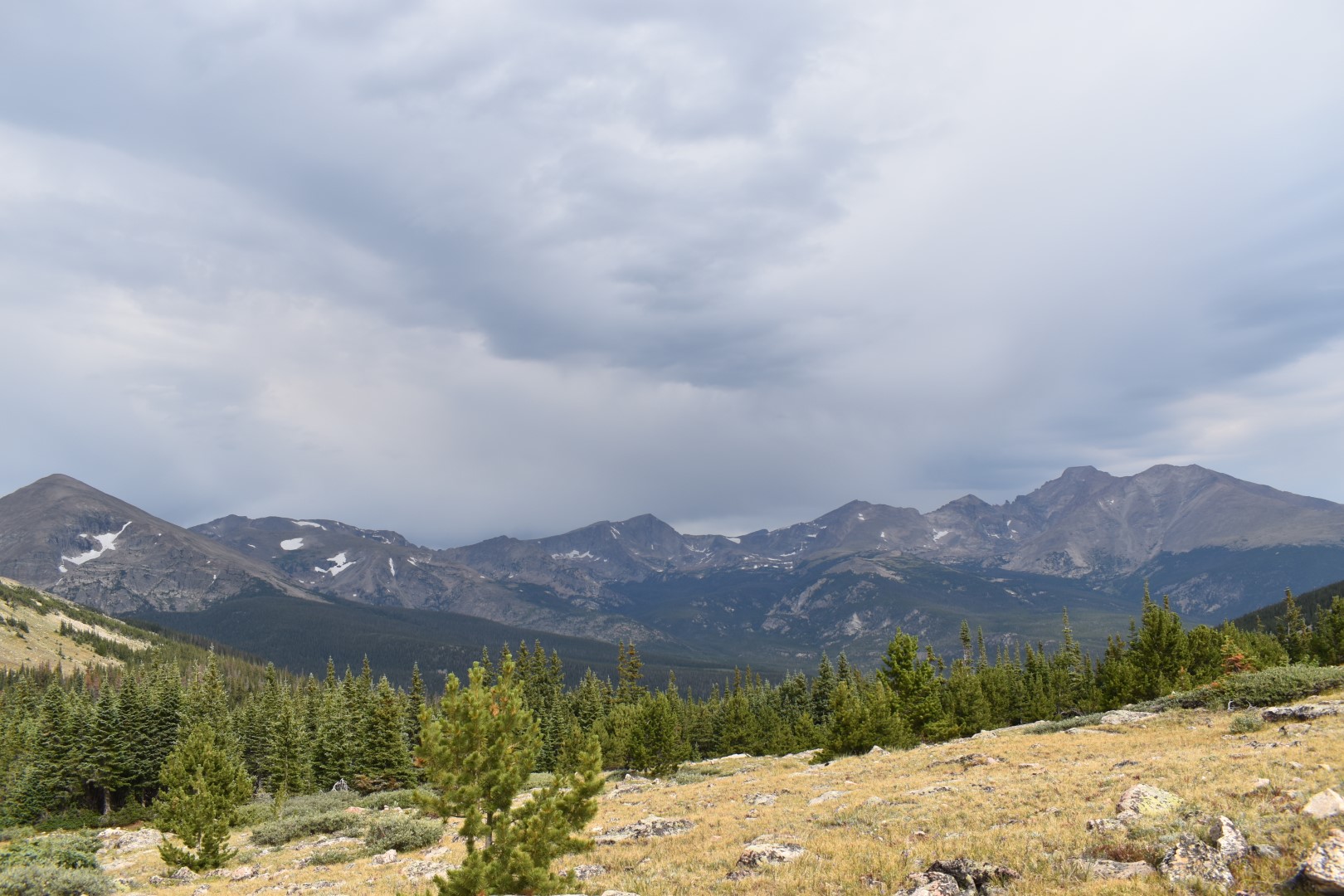
After a few miles in the forest, the trees thinned a bit and I could finally see the surrounding mountains.
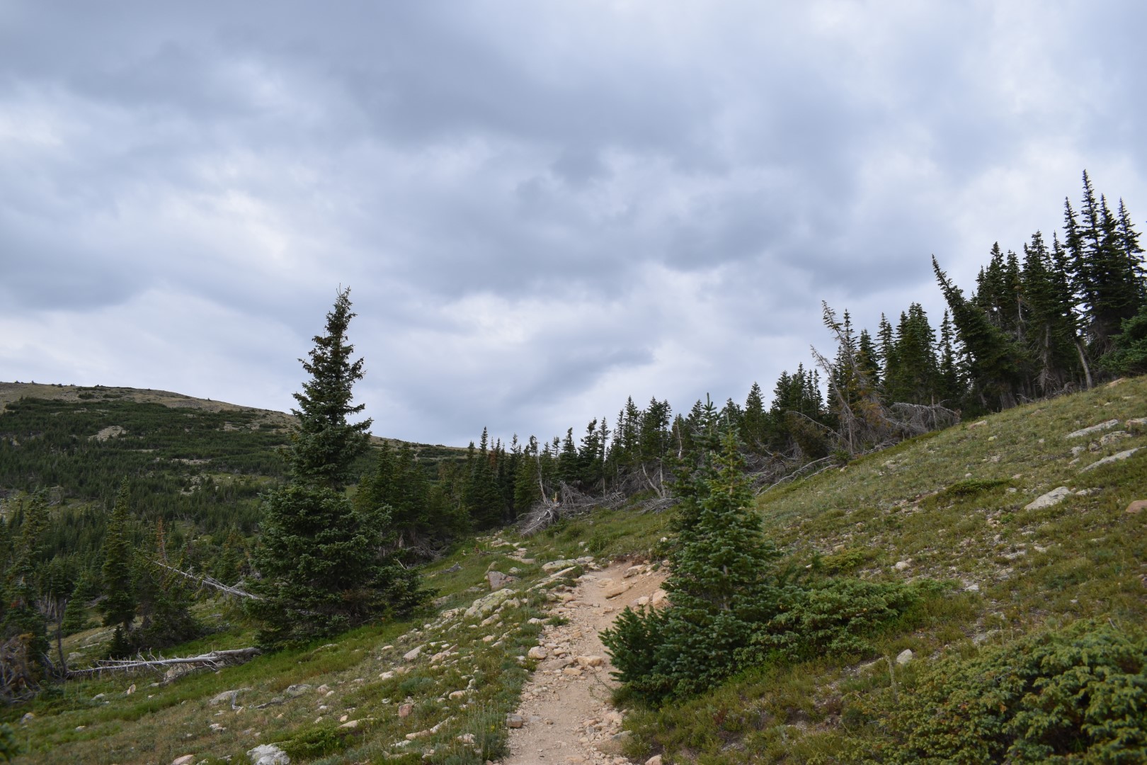
There is one final long switchback just before treeline. Once past that, it’s an easy hike to treeline and the saddle between Saint Vrain Mountain and Meadow Mountain, an 11er. I considered adding Meadow to my hike as well if time and weather allowed.
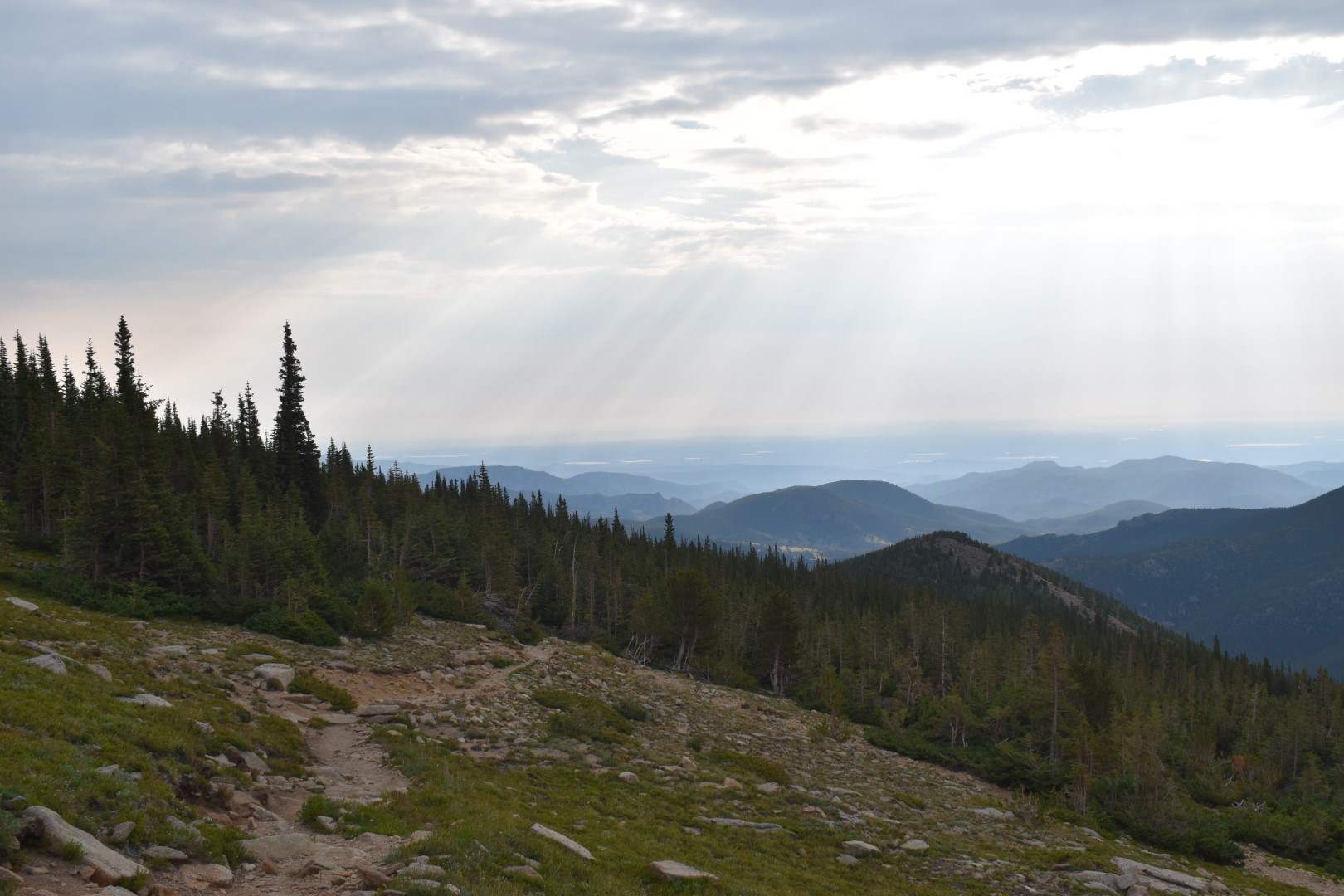
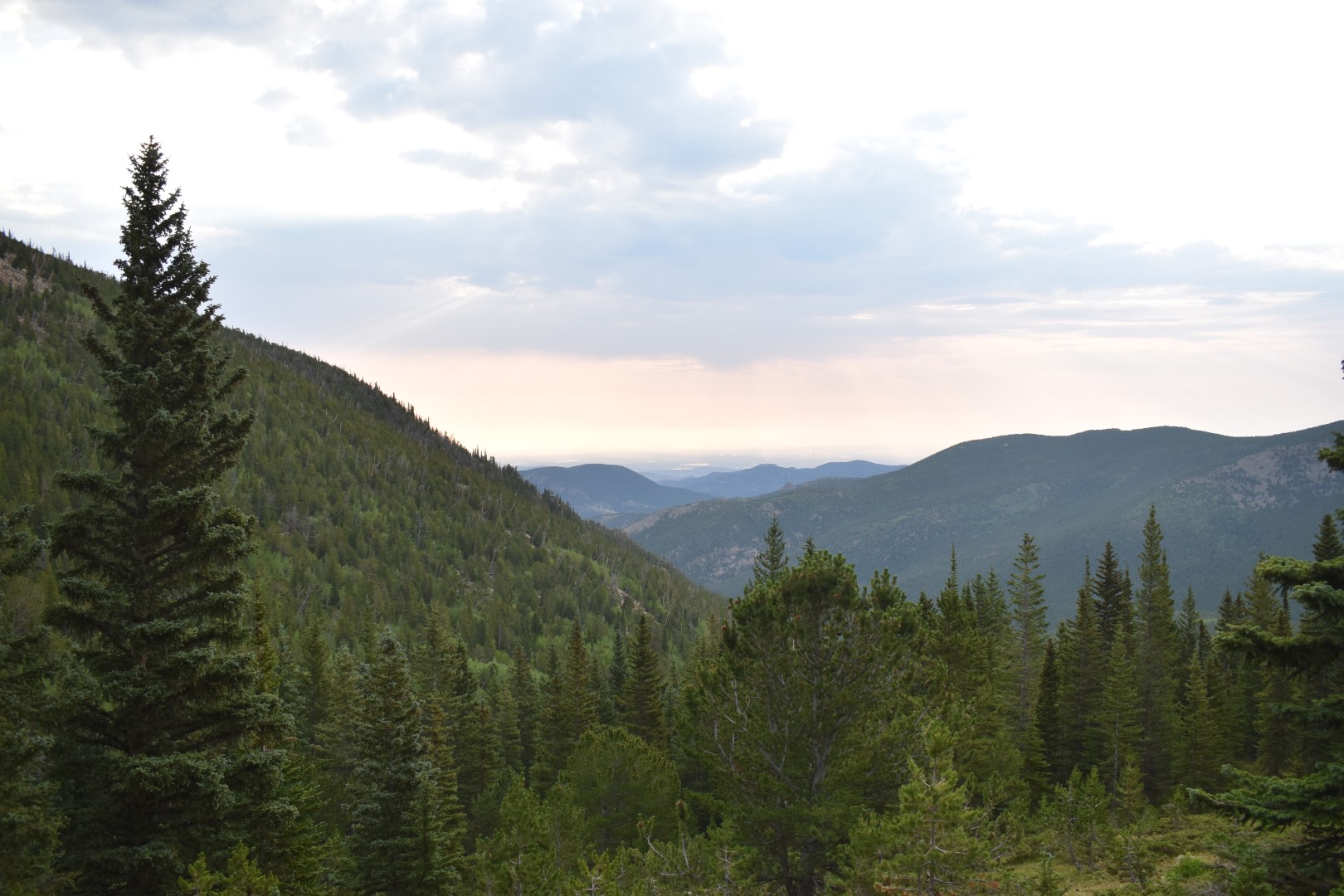
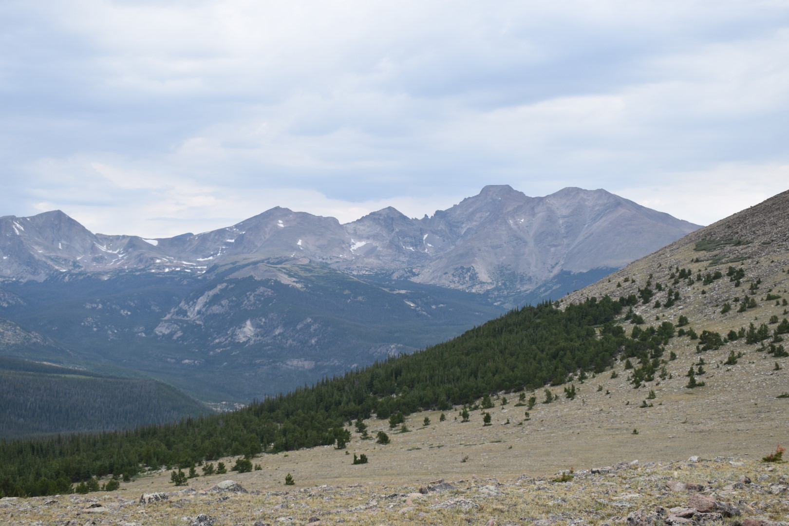
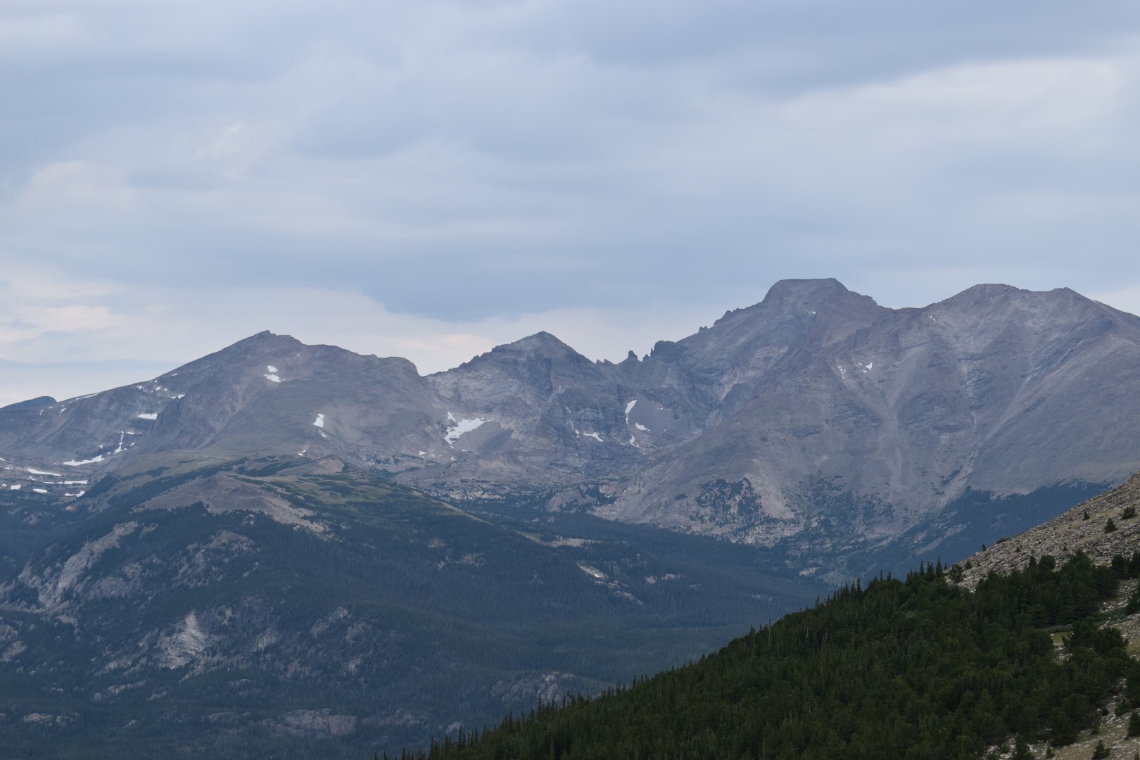
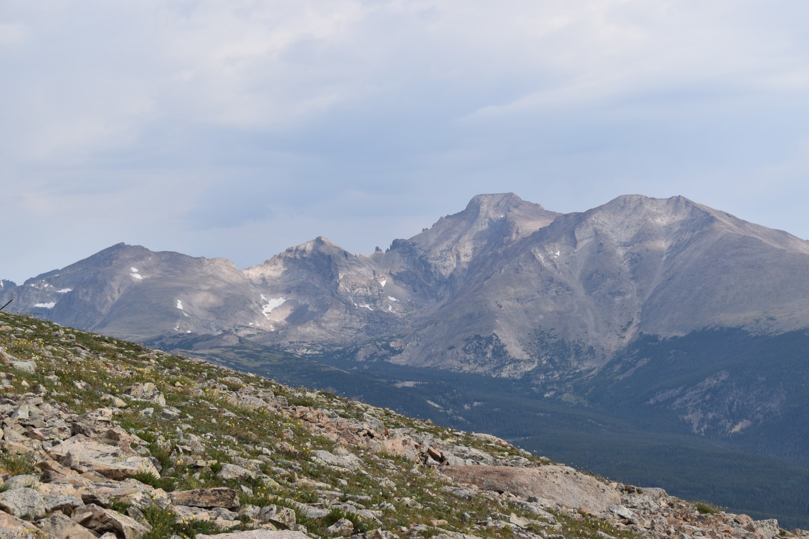
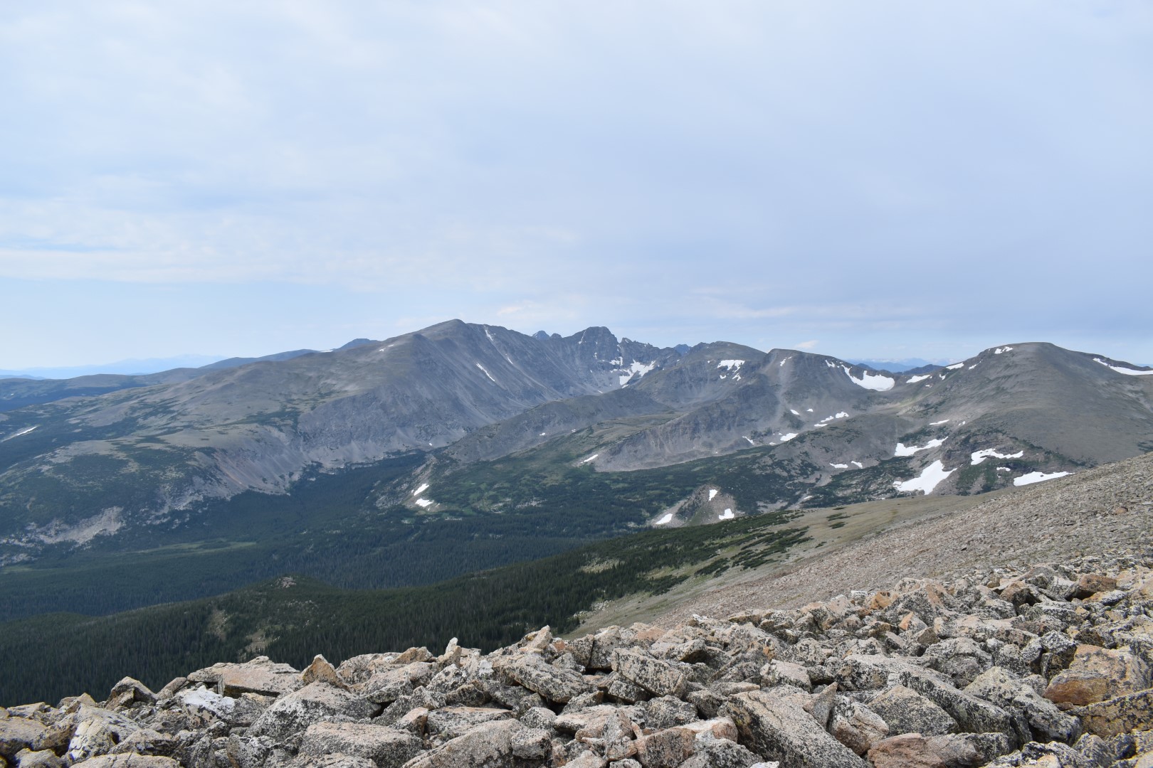
The Saint Vrain/Meadow saddle is a destination in itself. In fact, many hikers were turning around there, satisfied with their efforts at reaching this scenic vista. Many of Rocky’s high peaks are visible and 14er Longs Peak (the only 14er in the national park) is incredible from this angle.
Although I was more than happy with the expansive views, the saddle wasn’t my final destination. I turned south to continue along the Saint Vrain Mountain Trail and crossed into (and then right back out of) Rocky Mountain National Park.
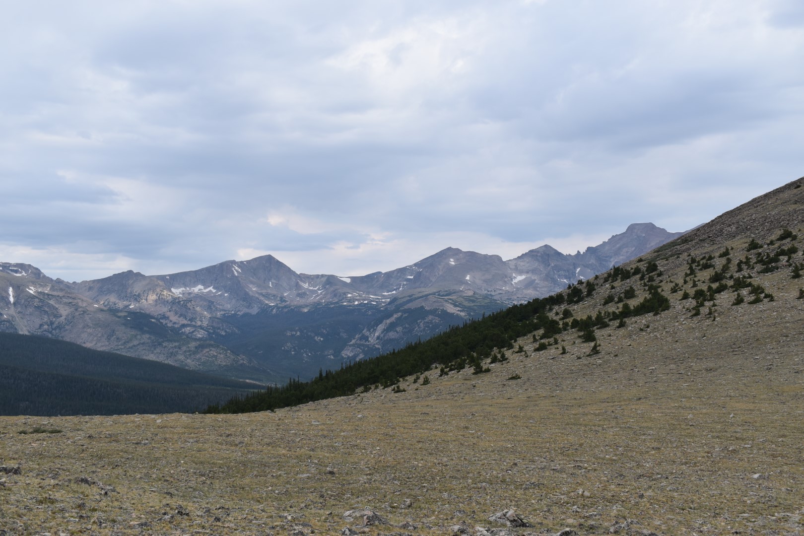
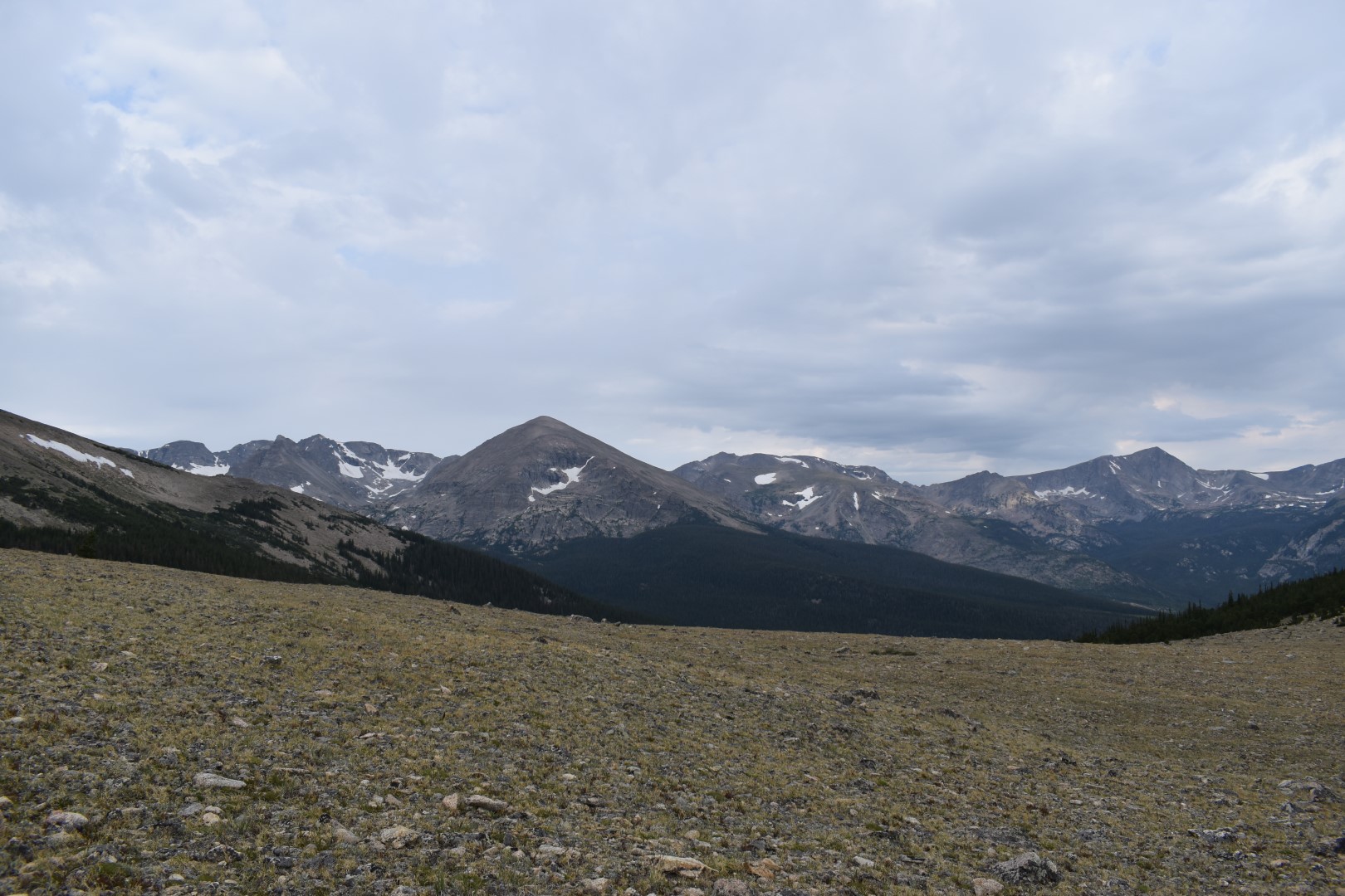
I found the views to get even better just after the saddle. Even if you’re not interested in climbing Saint Vrain Mountain, I’d encourage you to travel a little past the saddle for a better view of Longs Peak.
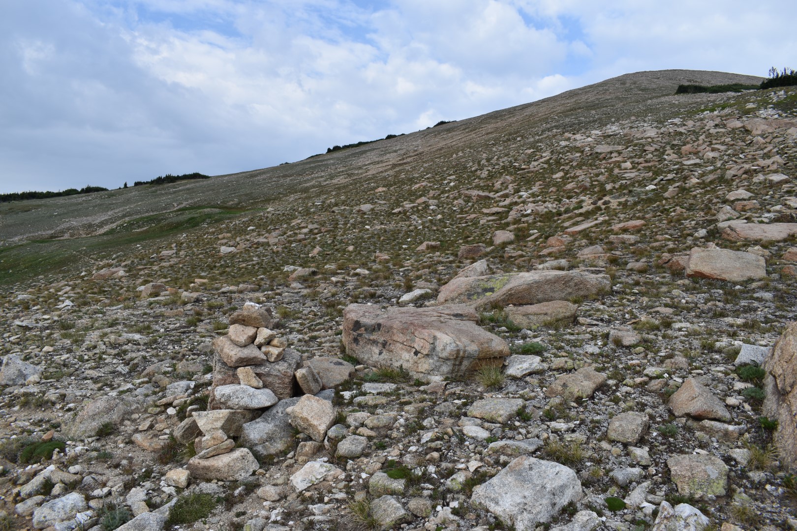
Contrary to its name, the Saint Vrain Mountain Trail continues right past Saint Vrain Mountain, skipping its summit by about 800 vertical feet. This last bit was up to me to find the best route and it ended up being very straightforward.
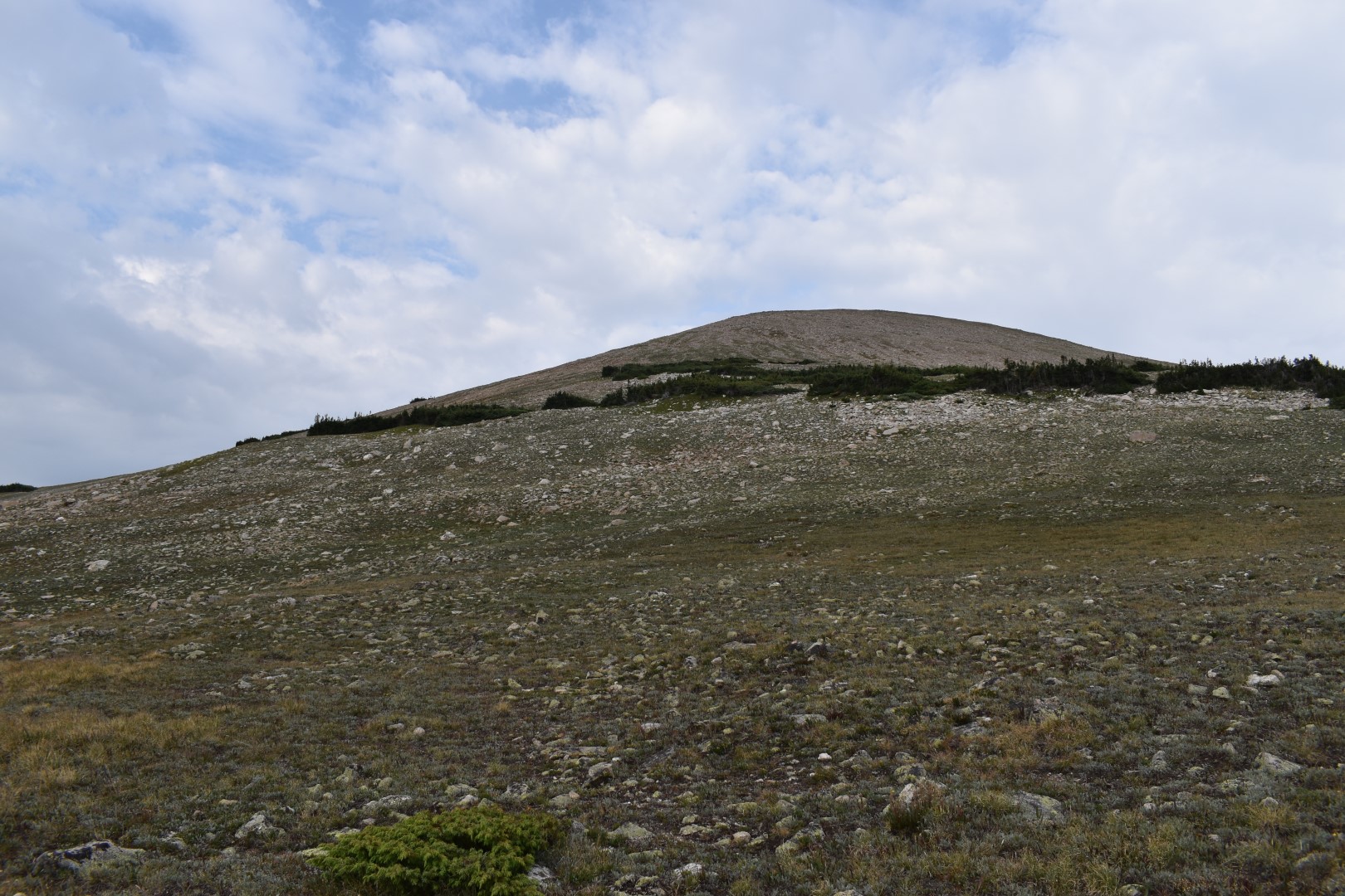
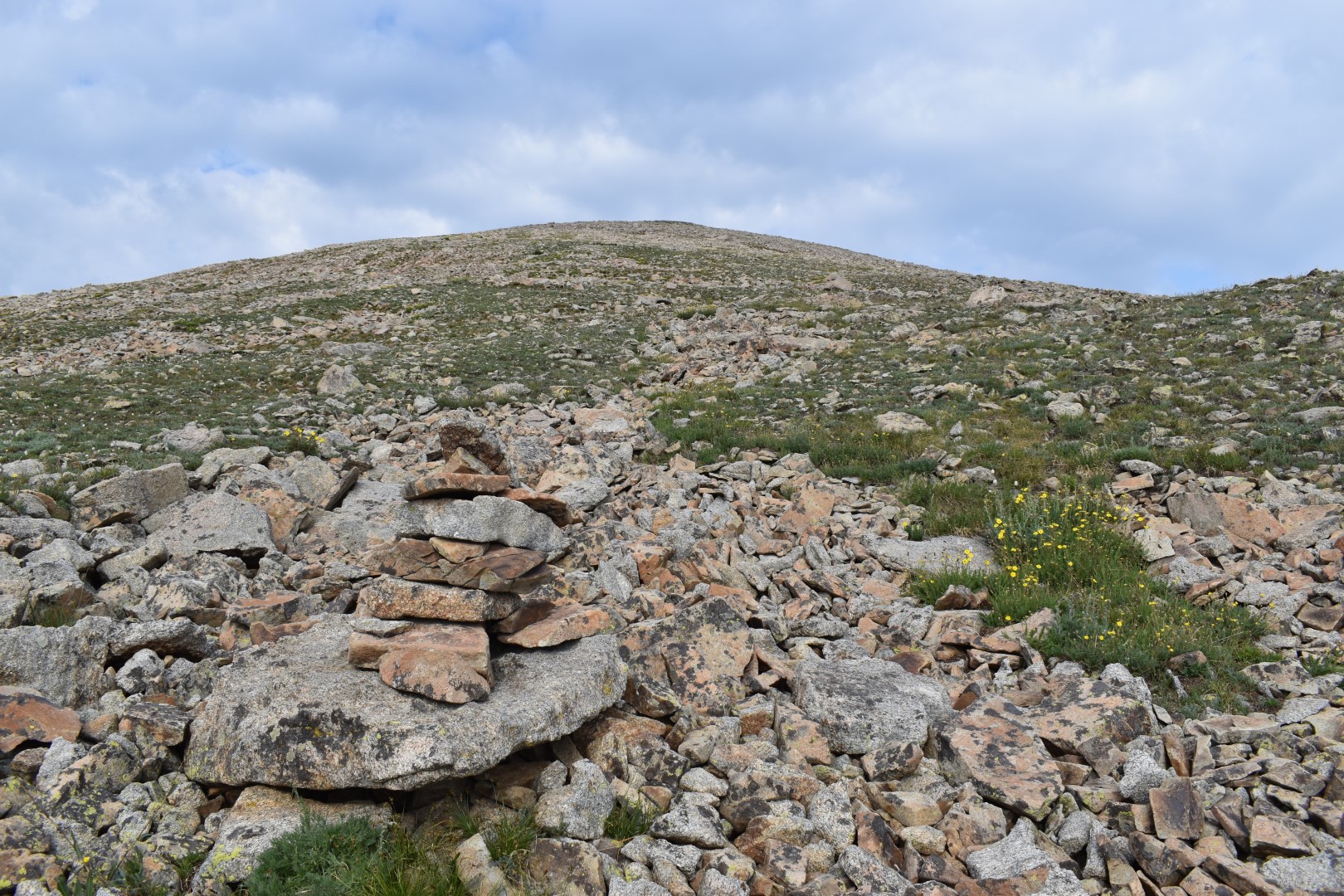
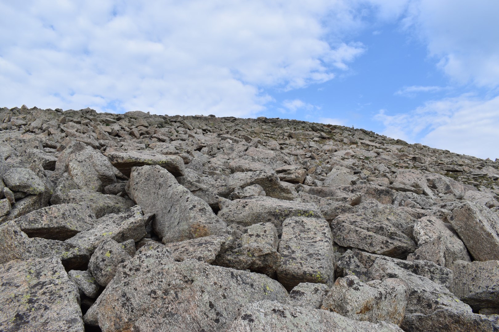
I wanted to avoid the trees and bushes (see above picture) so instead of heading directly up the mountain, I stayed on the trail for another minute or two. I saw a cairn which appeared to mark an ideal starting point for the last push to the summit. From the cairn, I could avoid all of the trees and bushes, keeping me on easy grass and rock.
Even off trail, the hiking was moderate, though unrelenting. I found a number of other cairns as I ascended so it was clear that the way I chose is a common route.
The top of the mountain turned from grass to talus relatively abruptly but I did happen upon a faint trail that easily guided me up.
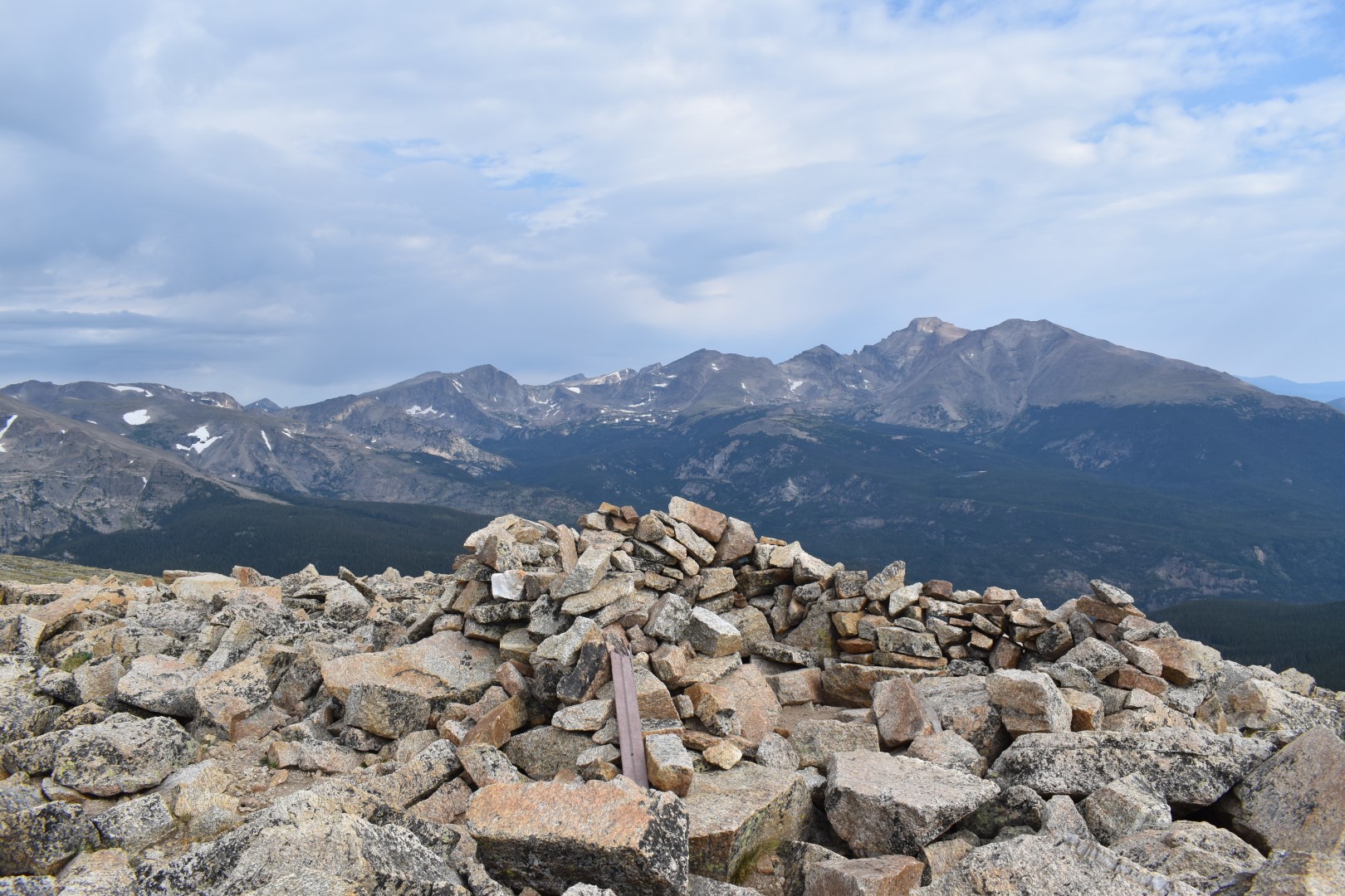
The views from the summit weren’t much different than what I’d seen all morning, but there’s something about working hard for (and then attaining) a summit that makes everything seem so much more spectacular. Two women had reached the summit just before me and we soaked up the scenery together for a few moments.
The wind was picking up and darker clouds were moving in so I didn’t stay long. I followed my approximate ascent route back down to the trail, where I ultimately decided not to attempt Meadow Mountain. I’d made good time all morning and could probably summit before the storms hit, but I didn’t want to risk it. I can always come back another time if one day the 11ers beckon to me.
I followed the now very busy trail back down into the forest and all the way to the car. It sprinkled on and off and many hikers stopped to ask me questions. The once nearly empty parking lot (and road) was overrun with cars by the time I got back. I guess it pays to get an early start. I drove home happy, already reminiscing about this amazing hike and dreaming up what I’d do next.
Chelsea

Great photos and commentary
LikeLike
Thanks Andrew!
LikeLike
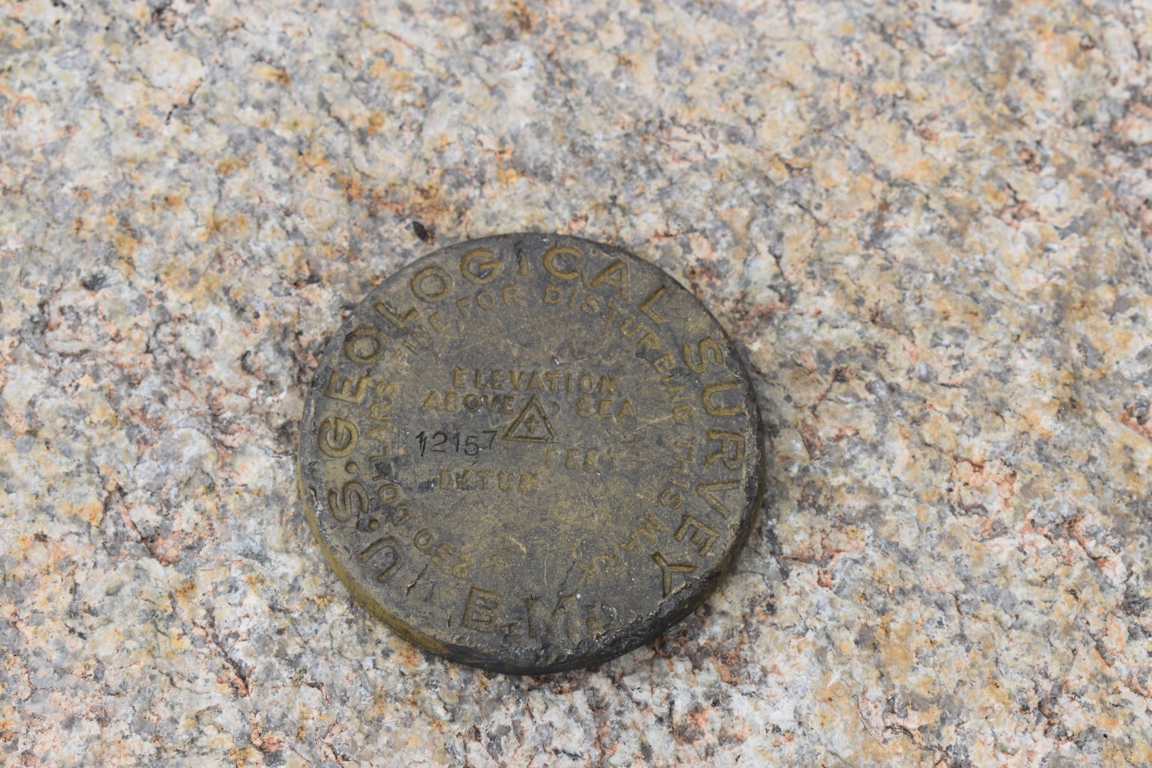
A great hike of 9 miles. The marker at the summit is greatcoat see. All beautiful photos and views!
LikeLike
Thanks Helen! I really enjoyed this one.
LikeLiked by 1 person
Reblogged this on Love and Love Alone.
LikeLike
Wow that looks like quite the hike. What a varied landscape you went through and all sorts of different trail conditions! Thought it was funny about the dogs not allowed, but then allowed again…hmmmm haha
LikeLike
Yeah the dog restrictions are a mystery to me…oh well haha. It was a beautiful hike regardless!
LikeLiked by 1 person
It seems really dumb that they didn’t just make the trail outside the park boundary. It doesn’t look like there’s any terrain to avoid or anything. Hmmm. Anyway… those views of Longs are 😍
LikeLike
Right!? I wonder if they built the trail and then realized later that it was actually in Rocky…who knows! You HAVE to add this one to your list, you will love it!
LikeLiked by 1 person
That makes sense. Or they re-surveyed and adjusted the boundary or something. Who knows 🤷♀️ Just added it to my to do list!
LikeLiked by 1 person
Hi Chelsea…many thanks for dropping a “like” on my blog yesterday…much appreciated. Thoroughly enjoyed your post – you have hills that are a a wee bit bigger than ours here in Scotland…well a good bit bigger actually! Noticed your comment about not summiting – we have a saying in our hillwalking community “the hills will always be there tomorrow” – we reckon it’s a philosophy that creates the best mindset to tackle the mountains. We’re lucky here in that there are very few no-go areas for dogs – they just have to be kept under close control. My biggest access issue was having to lift 37kg of slightly podgy Labrador over difficult fences 🙂 Ken
LikeLike
Hi Ken, thanks for stopping by! We have the same saying here though we say mountains instead of hills. 🙂 I’ve never been to Scotland but I’d love to visit someday! Most trails in Colorado allow dogs but the National Parks (all throughout the US) generally don’t allow dogs except in developed areas. Since this trail crosses over the National Park boundary (though just barely), dogs aren’t allowed on that one section of trail. It’s more a technicality than anything that is likely to be enforced. Just a weird situation but I was glad I left my dogs home this time just in case a ranger happened to be up there.
LikeLiked by 1 person
Spectacular views – thanks for bringing us up the trail with you!
LikeLike
Thank you! I really enjoyed this one.
LikeLike
Pingback: Mount Audubon (13,223′) | Colorado | 10/08/20 – Colorado Chelsea